
Location: Hinohara, Haga-cho, Shiso City, Hyogo Prefecture
Date of interview: 2011/04/04 (Monday)
View of the embankment on the lake side from the left bank
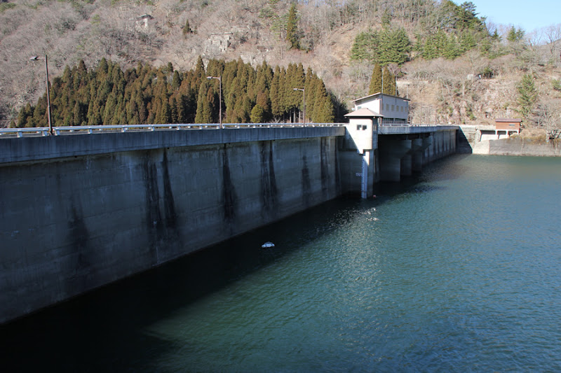
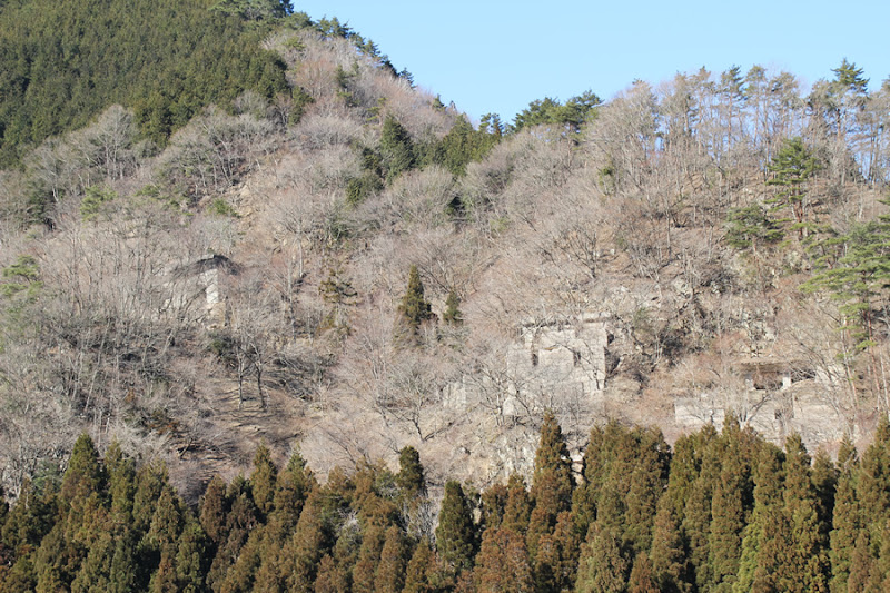
We approached Hikihara Dam from the backwater side via National Route 482 and National Route 29 Wakasakura Road from Myogadani Dam (1680-Myogadani Dam). The dam lake side is a very standard levee.
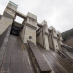
The Hikihara Dam was initiated in 1941 as a river control project on the Ibo River for the purpose of industrial water and power generation. The project was suspended for a time, but construction resumed in 1953 for the Ibo River Comprehensive Development Project, Hyogo Prefecture's first multipurpose dam for flood control, irrigation, power generation, and industrial water use. It was completed in March 1958.
By the way, "Shiso City" is not easy to read.
View of a patrol boat

A patrol boat was tied up.
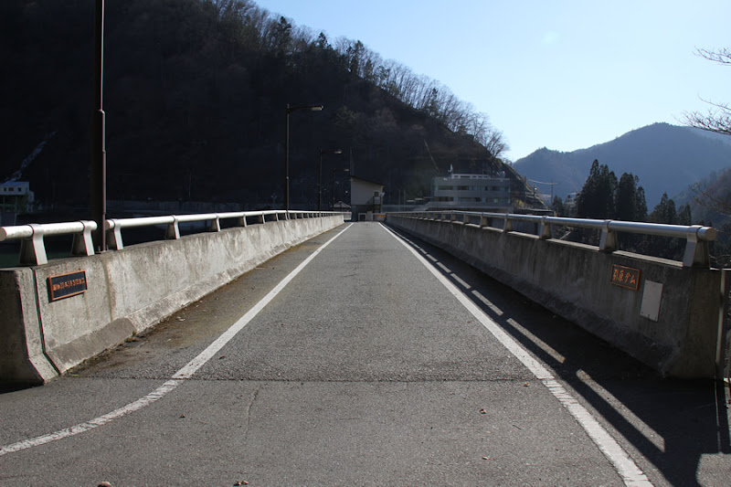
View of the top edge from the left bank
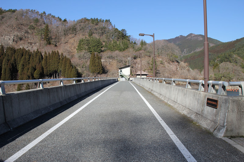
The top edge is open to vehicular traffic. It may be a great place for hiking, as there seems to be an extensive walking trail.
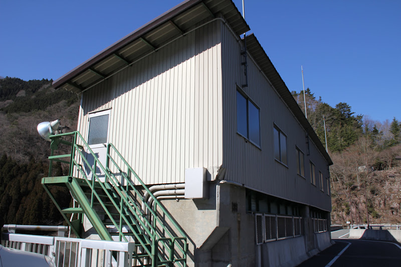
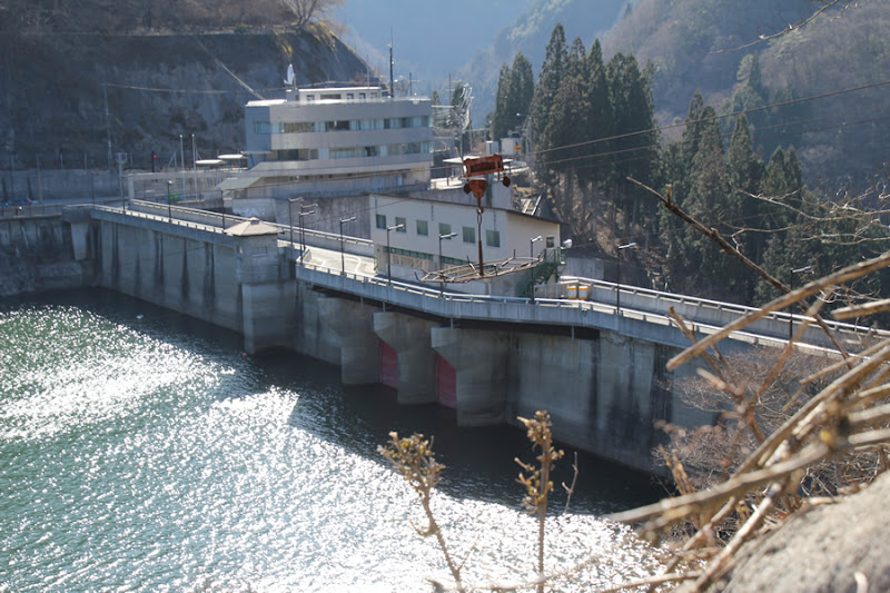
Hikihara Dam Management Station, Hyogo Prefecture

It is quite a magnificent management office.
900mm Howell banger valve
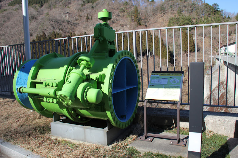
And a 900mm Howell Banger valve that was once used is on display by the administration office.
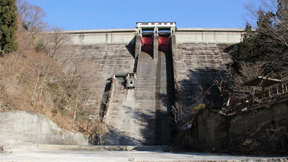
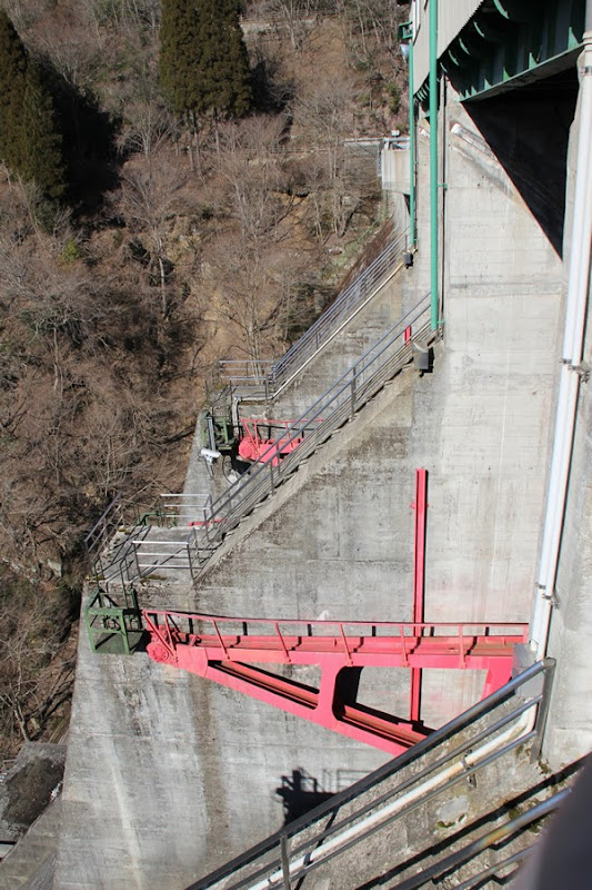
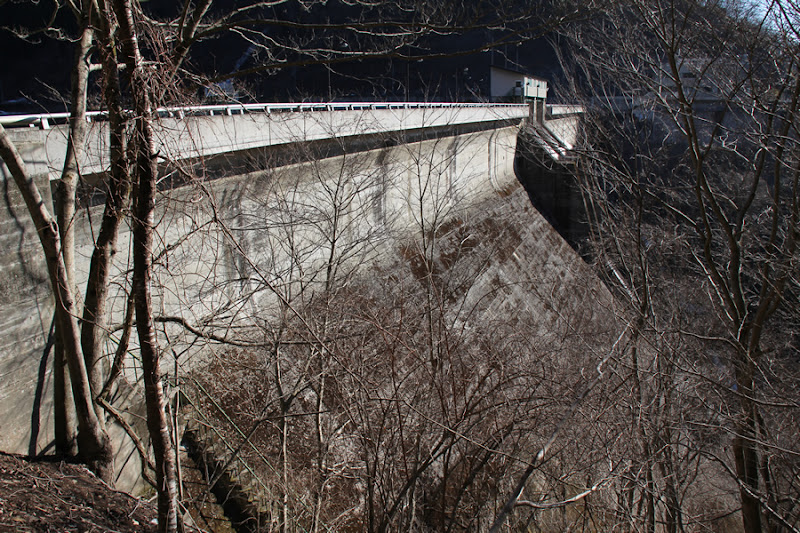
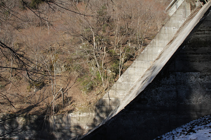
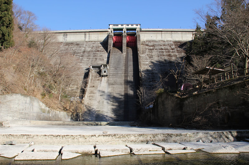
View of the levee downstream from the left bank

It is a slenderly designed dam that is hard to believe that it was completed in 1958.
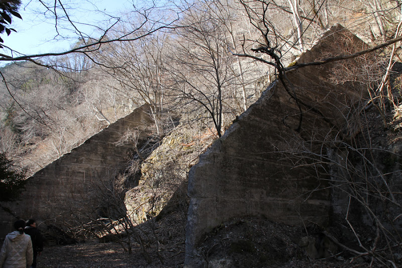
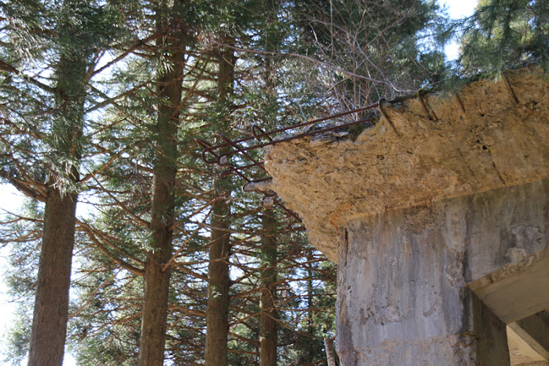
Remains of cable cranes, batching plants, etc.
Looking across the river, the remains of a cable crane and batcher plant can be seen.
View of the water intake system from the top
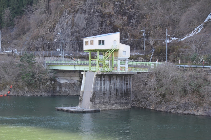
Is it a water intake facility for power generation?
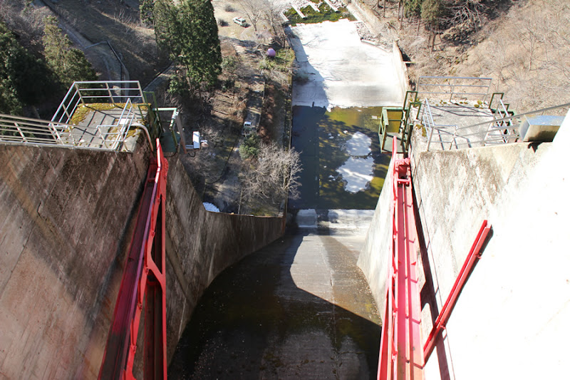
View of the Carauko Bridge from the top
I wonder what "karauko" means.
View of Gate Pier
The gate pier and the gate operation room built on top of it.
View of the administration office from the top

Somehow, I can see a figure. It must be someone inside.
View downstream from the top

I do not see any kind of river maintenance discharge facility directly below. It may be that the river is discharging a little more in front of this dam. Moreover, there may or may not be a sub-dam...
View of the gate from the top
If you look closely, you can see a staircase hidden inside the pier. The structure is somewhat like the Taifu Dam (989-Taifu Dam/Yasuoka Dam) on the Tenryu River.
View of the conduit from the top edge
The gate looks red so it looks as if it is Chubu Electric Power. Also, it looks like the downstream is a park. There is a car parked there, so let's go there later.
View of Gate Pier
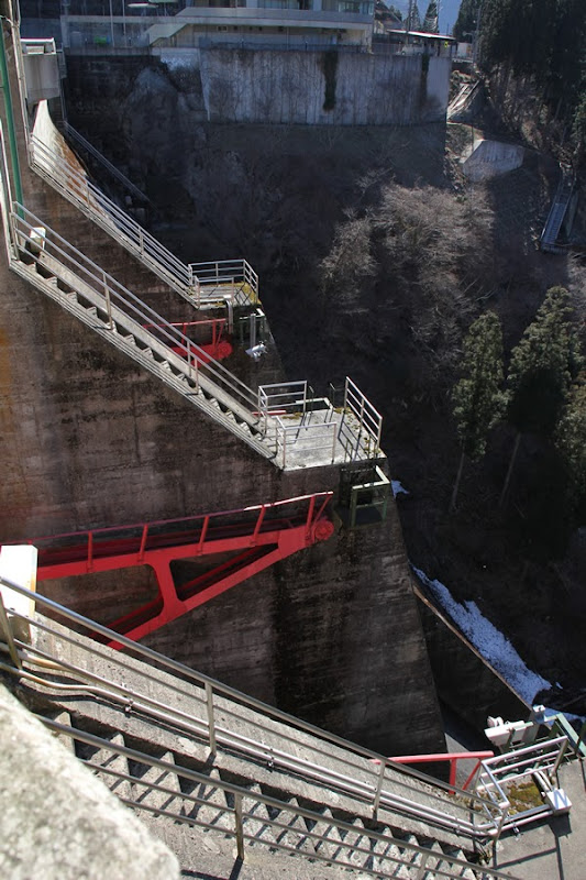
I mentioned that the stairs built into the pier are similar to the Taifu Dam, but this one is a bit more angular.
View of the embankment on the lake side from the right bank
The dam lake side is a very normal embankment. The area around the crest gate has been rounded off.
monument

Was it built to commemorate the construction of the dam?
View of cable crane for dust removal
A cable crane was installed for dust removal.
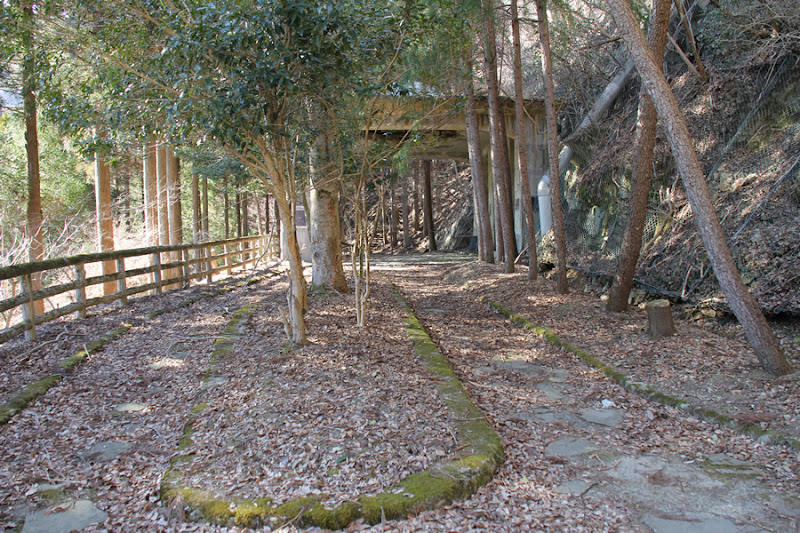
Walking path using the remains of a cable crane running on both ends

This dam site is quite enjoyable because there are remains here and there that remind us of the time when the Hikihara Dam was constructed. This is not just a walking trail, but a walking trail using the remains of a cable crane running on both ends. I think such a dam is rare.
Cement silo ruins

This is the site of a silo used to temporarily store cement during the construction of the dam, which had a capacity of 7 tons. I think these remains are good to explain to elementary school students when they visit the dam.
Probably the remains of a fallen rock and a rotting chair
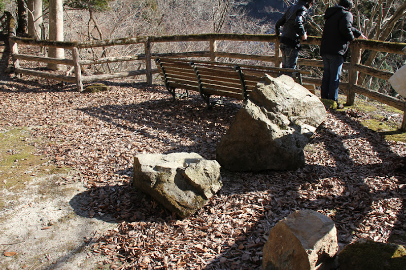
Perhaps it is a stone that fell from the slope. And the chairs are rotting away and don't look very comfortable.
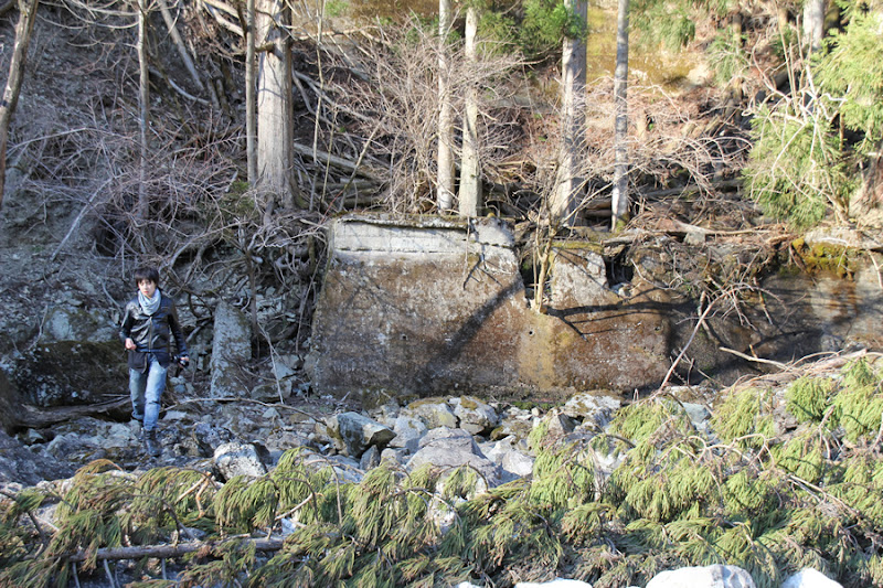
Aggregate storage bin site
This is where the aggregate was sorted by size. From here, they were transported by conveyor belt to the concrete mixer.
Badcher plant site
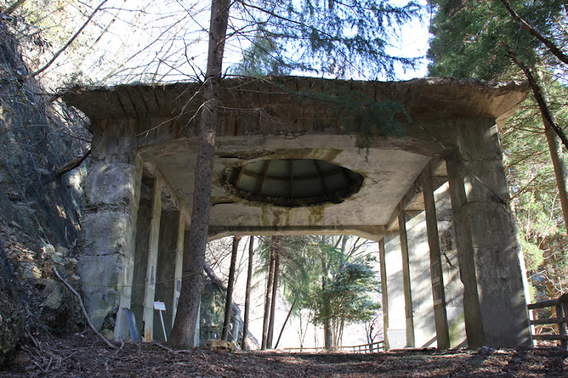
The most eye-catching among the dam construction remains of the Hikihara Dam is probably this batcher plant site. A dome-like structure covers the ceiling, but at the time of construction, this was not a dome but a building with a concrete mixer inside.
Ceiling of the former batcher plant
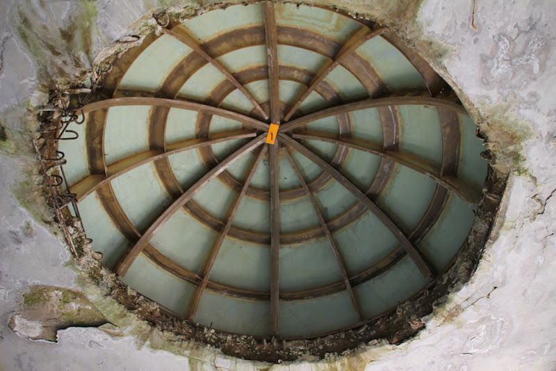
It is not originally domed here, but it is an odd sight.
Plant equipment active in construction
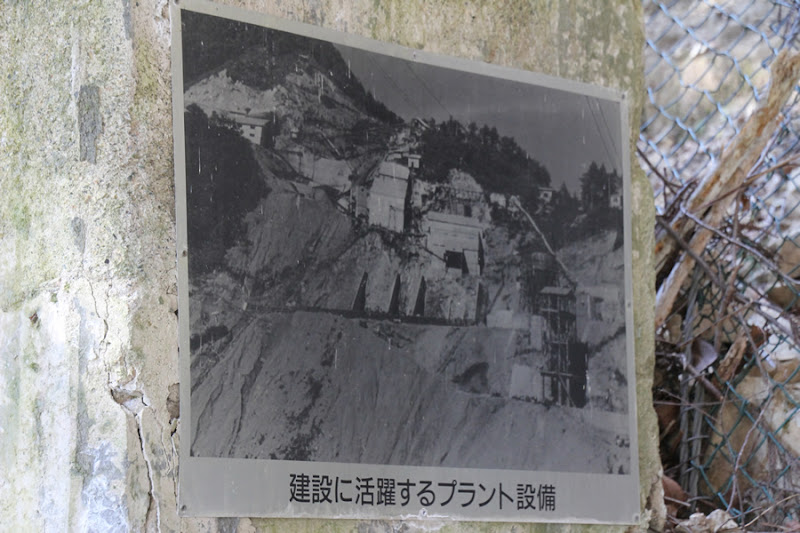
At the site of such a batcher plant, photos from the time of construction are on display. This is quite valuable.
Batcher plant at the time it was used for construction
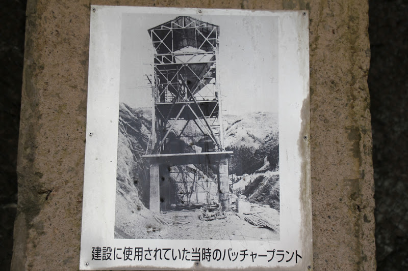
Here is exactly what it looked like decades ago in the very place where we stand today.
Dam site before construction began (top), Hikihara Dam immediately after completion (bottom)
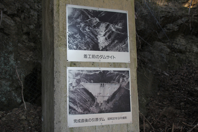
It looks like an outdoor PR facility, but it also displays photos of the dam site before construction began and the Hikihara Dam immediately after completion.
Hikihara village before submergence

Some may visit here to reminisce about those days.
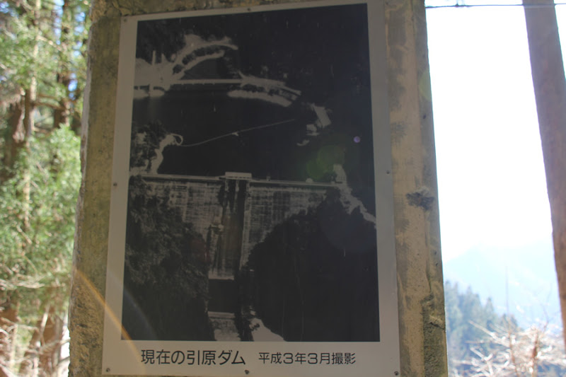
The present...but 20 years ago, Hikihara Dam
It's hard to make these displays easy to maintain, lol.
Hikihara Dam under construction
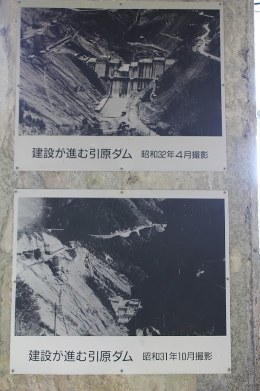
Although I do not feel that the order in which they are posted is reversed, they are valuable record photos from the time of construction.
First concrete pouring ceremony
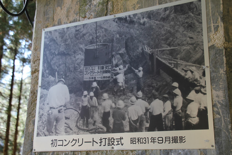
The first pouring was made with all the best intentions in mind.
Aerial view of Hikihara village before submergence (top), Ondolhu Lake seen from the sky (bottom)
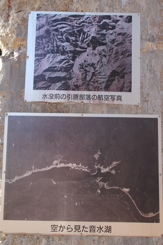
Aerial photographs are also on display, although they have deteriorated a bit.
Corner of former batcher plant
However, such batcher plants have deteriorated. After a number of years, they may be doomed to be torn down due to obsolescence.
bunker line
This is where the rails were laid to transport the concrete carriers from the batcher plant to the top. This is the modern-day equivalent of the remains of a transfer car rail.
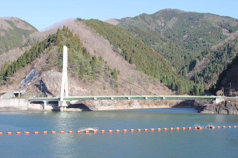
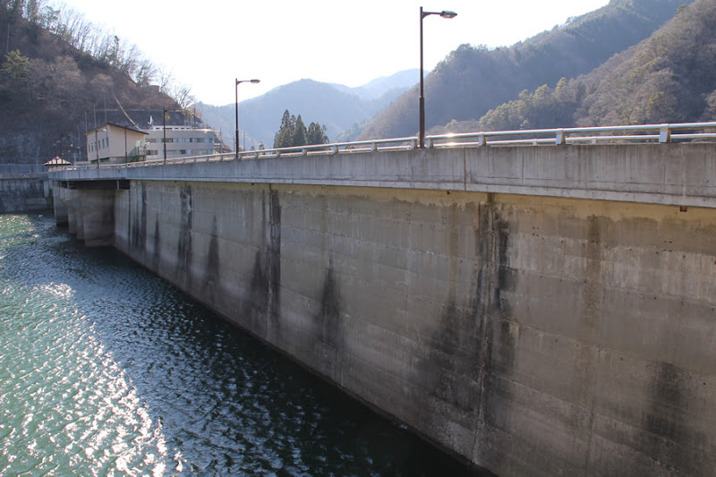
View of the levee downstream from the right bank
I hope the view is a little better....
View of the top edge from the right bank
Sleek top edge.
Hikihara Dam nameplate
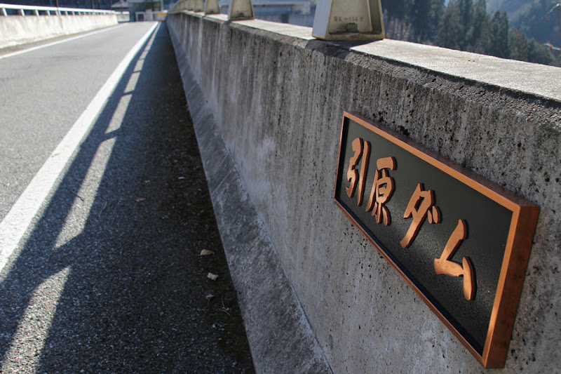
The nameplate appears to be relatively new in age when installed.
Most of the view from downstream

Then drive to the park downstream. The road directly downstream is a bit narrow and has a lot of bushes, so be prepared for some scratches to your itch.
View of the Howell Bunger Valve

It's after the replacement of the Howell Banger valve that was displayed outdoors. I wonder if it will pop out like the Onui dam.
Sub-dam? View of the
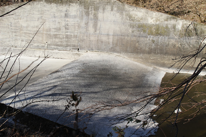
It is a very low structure for a sub-dam, if you can call it a sub-dam.
View of the entrance to the audit corridor

At the entrance to the audit corridor. Will it be used for tours?
View of the crest gate and conduit wall from directly below
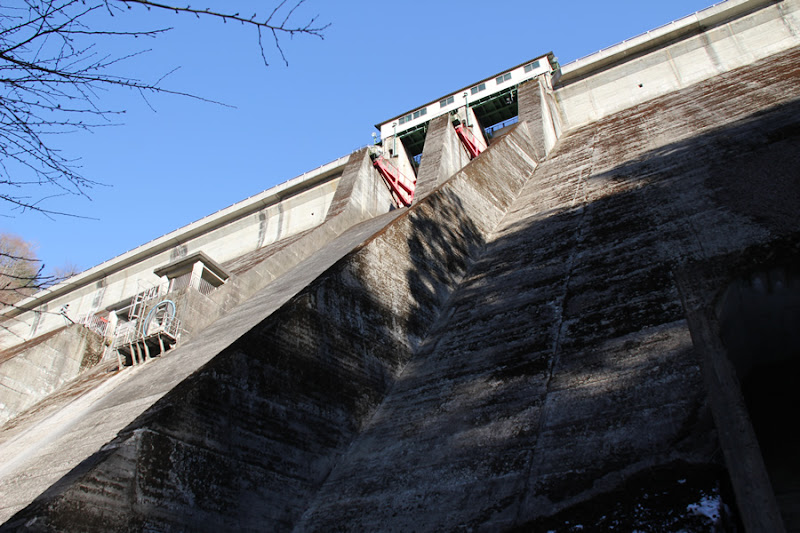
The Hikihara Dam can be viewed from directly below.
View of conduit and conduit wall
The flow-conducting wall has a very ordinary design.
View of Ryukyu-kun and the dike body in a mysterious pose on a mysterious circular chair.
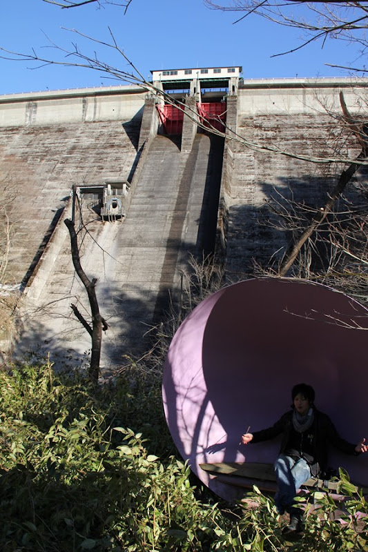
I'm not sure what it is, but I'm not sure what the pose is. Perhaps he is feeling the dam vibrations that only the royal family can feel.
View of Crest Gate
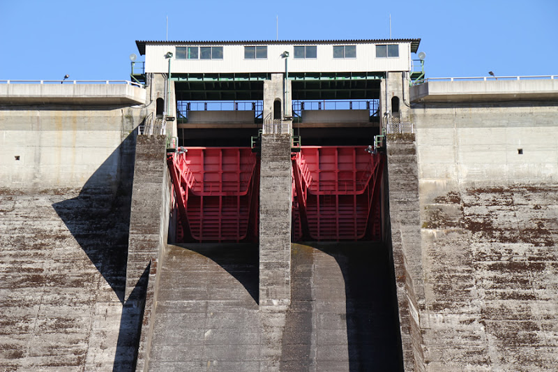
The gate area looks tight with symmetry. The red gate is also impressive.
View of the levee from the water park directly below
Downstream is a water park, so you can enter the river. I should have been a little more enthusiastic and put the levee in the middle as a subject.
Temporary drainage tunnel? Temporary drainage tunnel?
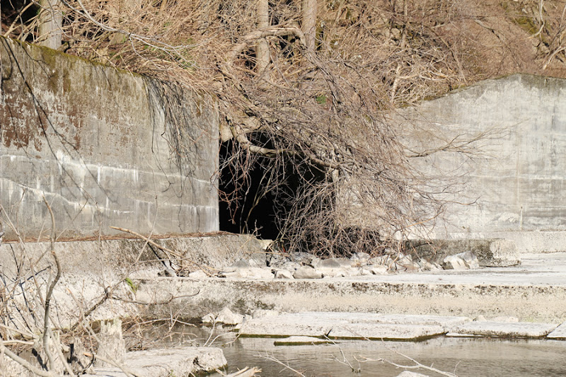
If you look closely, you can see what looks like a temporary drainage tunnel. Whether this is actually the case or not has yet to be confirmed.
Looking downstream

Downstream, as seen from the top end, there is not much water flowing, so it looks a bit lonely. I feel that a water park could use a little more water, but it may be a seasonal issue.
Law surface and Ryukun
I envy him for his light footwork that allows him to go there easily.
The Hikibara Dam is a dam that can be enjoyed from corner to corner. It is a dam that I personally recommend and fall in love with.
Hikihara Dam Specifications
| River Name | Hikibara River, Ibo River system |
|---|---|
| Objective | Flood control, agricultural disaster prevention, industrial and unspecified water, river maintenance and power generation |
| Model | gravity-fed concrete dam |
| Bank height | 66m |
| Bank length | 184.4m |
| Dam volume | 18,000m3 |
| Watershed Area | 57.5km2 ( Direct: 48.2km2 Indirect: 9km2 ) |
| Reservoir area | 88ha |
| Total storage capacity | 21,950,000m3 |
| Effective water storage capacity | 18,400,000m3 |
| Dam operator | Hyogo prefecture (Kinki area) (Hyougo) |
| Main body constructor | Kumagai Gumi |
| Year of launch | 1953. |
| Year Completed | 1957 |
| Name of Dam Lake | Sound Water Lake |
Other facilities/observations
| Parking lot | ○ | Because there is a parking lot by the administration office and a plaza downstream, I think you can stay there for a long time. |
|---|---|---|
| Toilet | × | |
| Park | ○ | |
| PR Exhibition Hall | × | |
| Fishing | ○? |

Comment
Atsushi Okita liked this on Facebook.
I miss it!
Oota Toshiaki Syunmyou liked this on Facebook.
Ryu: The prince of dam, right?
It's been three years too early.
Ryu It was right after the Dam Oji earthquake, wasn't it?