
Location: 72-2, Nibanno, Inunaki, Miyawaka City, Fukuoka Prefecture
Date of interview: 06/13/2011 (Monday)
There are no apparitions at the Inunaki Dam. There is nothing of the sort in this article either. If that is what you came here expecting, please back up your browser now. If you are going to disturb the locals with your test of courage, please don't go to the dam.
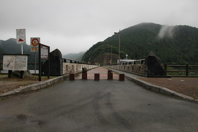
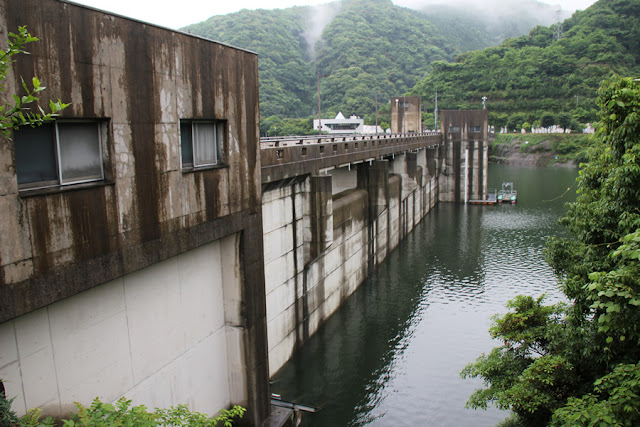
View of the levee from the Inunaki Bridge downstream
I left Nagoya late at night and arrived in Fukuoka early in the morning, but it was too early in the morning, so I came to Inunaki Dam to take a break and kill some time. It is difficult to go to the dam casually because there are limited places to park a truck.
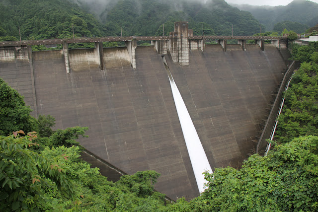
Discharge from orifice gate
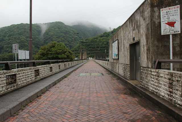
Well, it was raining steadily. Still, it had mostly stopped, but the wet bank was a nice touch. Also, the water was discharged from the orifice, which I think was a good thing. By the way, the Inunaki Ohashi Bridge is very bumpy because of the trucks passing by, so the bridge shook a lot when I was taking pictures.

Librarian's Lake Circle Park information sign
The name "Shisho no Umi" reads "Lake of Libraries." It is the name of a dammed lake. Why a librarian? I wondered why it was named after Librarian Kato, who was a retainer of the Fukuoka domain in the late Edo period (1603-1868). It is said that Librarian Kato had an iron mine built in Inunaki to confront foreign countries that were pressing for the opening of Japan at the end of the Edo period, and also built a mountain castle to shelter the lord of the domain in case of an emergency.

View of the levee downstream from the right bank
Early morning after the rain, the season is fresh green. It feels quite good to be bathed in negative ions.

View of the levee and downstream from the right bank
Inunaki Dam is a prefectural dam, but I felt that this sign looked somewhat like the Ministry of Land, Infrastructure, Transport and Tourism.

View of the top edge from the right bank
As you can see, the top edge is closed to automobile traffic.
View of the embankment on the lake side from the right bank
The moist and wet top rail creates a nice atmosphere. There seems to be some kind of relief embedded in it, so let's take a closer look later.

View of the embankment on the lake side from the right bank
The emergency flood discharge at the crest is a free overflow type, which is common in municipal dams.

Fountain Square
The "Fountain Plaza" at the right bank dam site. I thought it might represent the dam, but it doesn't seem so....

View of the dam lake from the right bank
The name "Inunaki" comes from a story about a hunter who was hunting with his hounds with a rifle in the mountains near here, and shot his hounds to death because they would not stop barking and he could not catch anything. However, a serpent over 5 meters long appeared above their heads. The hunter regretted shooting and killing the hound, which had been barking mainly to warn of danger, so he gave up his hunting rifle, became a monk, and built a pagoda on the mountain to offer a memorial to the hound. Since then, it has been called "Inunaki.

View of the incline from the right bank
An incline has been installed on the left bank.

View of the selective intake tower from the right bank
It is equipped with one 2m x 6.2m steel roller gate surface intake gate and six 800mm diameter steel sliding gate intake gates.

View of the orifice gate from the right bank
This is the drinking mouth on the lake side of the dam that was discharging from the downstream side.

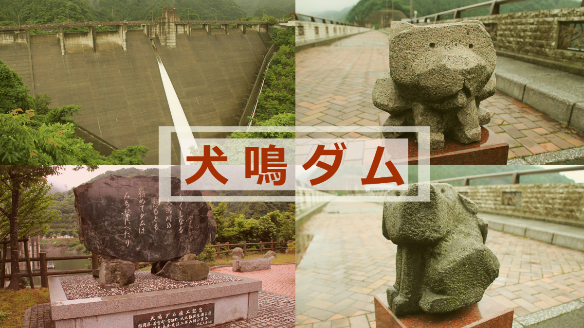
Stone statue of dog 1
This is a stone statue of a dog that sits on top of a car stop pole at the top end. It is a little cute and interesting.

Stone Statue of Dog 2
There is another stone statue on one side, but this one is a dog! It looks like a dog.

A cassowary? A bush warbler?
This is a relief embedded in the top rail. Is it a cassowary or a Japanese bush warbler?

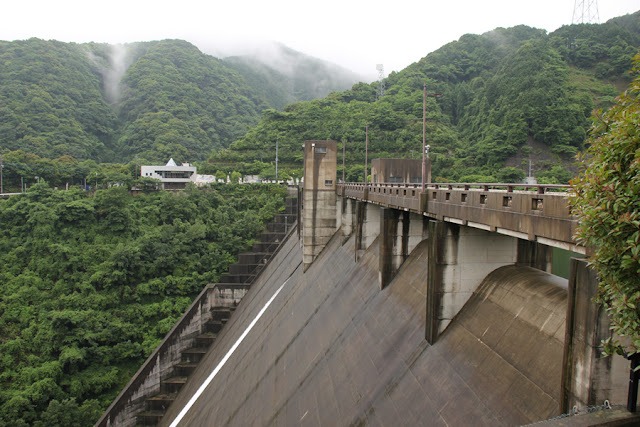
Discharge from the orifice and view downstream from the top edge
It is quite high, but the embankment height is 76.5m.

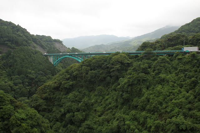
View of the Inunaki Bridge downstream from the top
It was approaching the morning rush hour, and there were quite a few cars flying by.
Water level measurement room (front) and elevator room (back)
This is a fairly large elevator room. The elevator is said to have a capacity of 6 people and a speed of 60 m/min.

Water intake equipment room
This is the entrance to the intake facility room. The specifications of the water intake facility are as described above.

Ship Equipment Room
The vessel is equipped with an electric hoisting system. The company owns two vessels: a patrol vessel and a dust collection vessel.

View of the top edge from the left bank
The top of the embankment is 230 meters long, which is quite long enough to not be able to see the other side of the river.
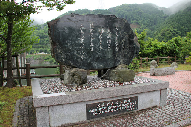
The dam has been built to quell the anger of the Chikushinaru Inunaki River.
The Inunaki River basin of the Onga River system has an annual precipitation of around 1,800 mm, more than half of which is brought in during the flood season.
Although river improvement work had been ongoing in this basin prior to the completion of the Inunaki Dam, a drastic solution was not achieved, and the torrential rains of 1953 caused extensive damage.
In addition, the area had suffered from drought several times in the past, with a major drought in 1966.
Large industrial parks were built in the surrounding towns, and the demand for water seems to have increased dramatically.
Therefore, the person who composed this haiku must have put all his feelings into it. We can read from this character that the completion of the dam was a long-cherished wish.
View of the embankment on the lake side from the left bank
There were no houses upstream, and although there are houses downstream, no one was taking a walk, even in the morning, probably because you have to climb quite a bit higher. It may be that it was just after the rain had stopped.
View of the levee downstream from the left bank
The wet embankment is truly wonderful and beautiful.
Inunaki Dam Management Station
I met a staff member who was perhaps making his morning rounds. I greeted him briefly, but I wondered what he thought of me with my single-lens reflex camera on such a morning.

Monument to Toyohiko Shinozaki
Upstream is the site of the Fukuoka Clan's Inunaki Annex, which was built by the aforementioned librarian, Toyohiko Shinozaki, who erected the monument.

View downstream from the right bank of the top edge
It looks like you can look up the embankment from downstream, but from Google Maps and Street View, it looks like there is a gate quite a ways in front of it and it is off-limits. It was a truck at the time and I was afraid of accidents in unfamiliar territory, so I did not go there, but it was a good decision not to go.

View of the right bank footing from the right bank
There are no handrails on the footings, which is a bit scary when going up and down the stairs.

View of footing on left bank from right bank
I see that the footing on the left bank side is integrated with the dike toe guide wall.

View of the reduction work from the right bank
It is exciting just to imagine what will happen to this small abatement structure when it is fully overflowed.

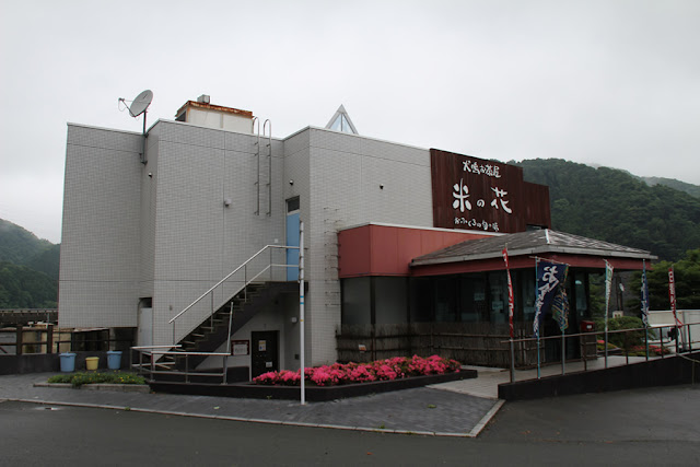
Inunaki Teahouse Rice Flower
There was a restroom near the control center, but it was not very clean, so I did not use it. I borrowed the restroom on the first floor of this store downstream. It seems to be part of the dam facilities rather than a store restroom.
The restaurant itself was out of business hours due to early morning, but they serve good food for lunch. I would like to go back to eat there someday.
The Inunaki Dam was a prefectural dam, but it was a dam that was full of roles and played an important role. Please visit it during your sightseeing in Kyushu. History buffs may also enjoy it.
Inunaki Dam Specifications
| River Name | Inunaki River, Onga River system |
| Objective | Flood control and agricultural disaster prevention, unspecified water and river maintenance water, water for water supply, industrial water |
| Model | gravity-fed concrete dam |
| Bank height | 76.5m |
| Bank length | 230m |
| Dam volume | 230,000m3 |
| Watershed Area | 6.1 km2 |
| Reservoir area | 23ha |
| Total storage capacity | 5,000,000m3 |
| Effective water storage capacity | 4,850,000m3 |
| Dam operator | Fukuoka prefecture (Kyushu) |
| Main body constructor | Shimizu Corporation, Sumitomo Construction Co. |
| Year of launch | 1970 |
| Year Completed | 1994 |
| Name of Dam Lake | Librarian's Lake |
Other facilities/observations
There is a fairly large parking lot at the right bank dam site. There is also one on the left bank, but the road is somewhat narrower. Restrooms are located near the management office and on the first floor of the Inunaki Tea House "Rice Flower.
| Parking lot | ○ |
| Toilet | ○ |
| Park | ○ |
| PR Exhibition Hall | × |
| Fishing | ○? |

Comment
Douken Norihiro liked this on Facebook.
Yusuke Kai liked this on Facebook.
Marubashi Satoru liked this on Facebook.
Keizo Imai liked this on Facebook.
Yohei Fukuda liked this on Facebook.
Ryota Mochizuki liked this on Facebook.