
Date of interview: Saturday, February 8, 2014
On this day, a group of good friends who are dam enthusiasts decided to visit "Kanefuku Mentai Park" in Tokoname, and we stopped by Maeyama Dam on the way. We stopped by the Maeyama Dam. Maeyama Dam is a regulating reservoir for Aichi irrigation water, which was originally inherited from Aichi Prefecture, which was engaged in a prefectural irrigation and drainage project, and is now managed by the Japan Water Agency. The embankment is an earth dam.
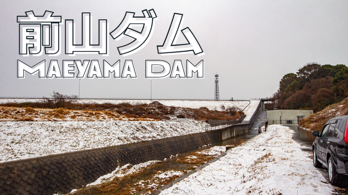
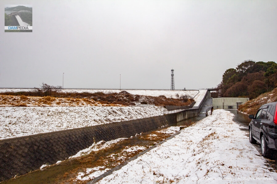
View of the downstream face of the dike
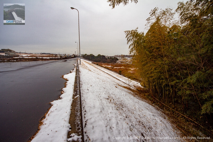
The day before this day, there was heavy snowfall, and although fellow enthusiasts were originally scheduled to come from Kyoto, they were unable to come because they had normal tires. As you can see, Maeyama Dam was also snowed in.
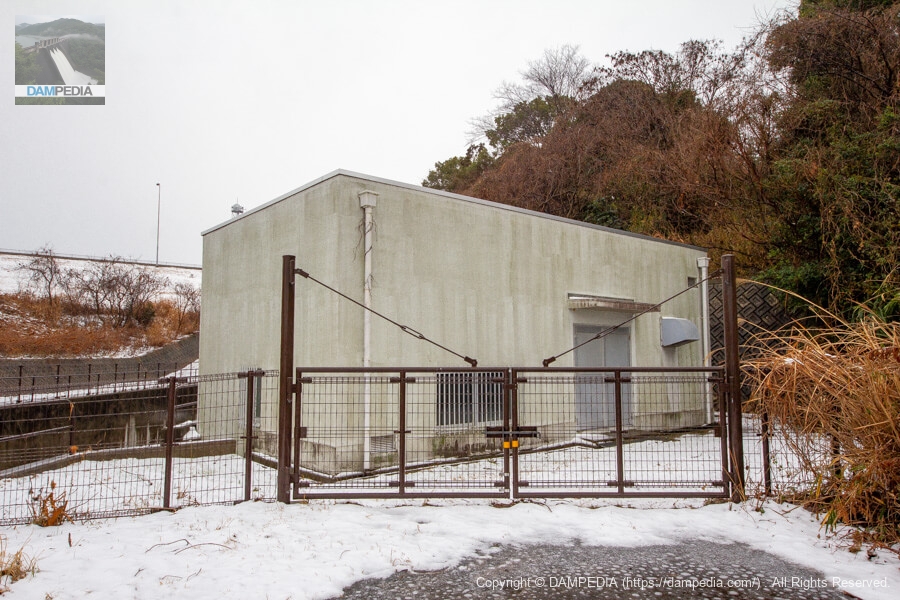
Mystery equipment
Is it a discharge valve room for river maintenance?
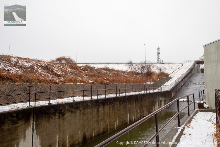
conduit
We are looking at the conduit from in front of the mysterious facility. The embankment height is not so high (18.4m), so it is a gentle conduit.
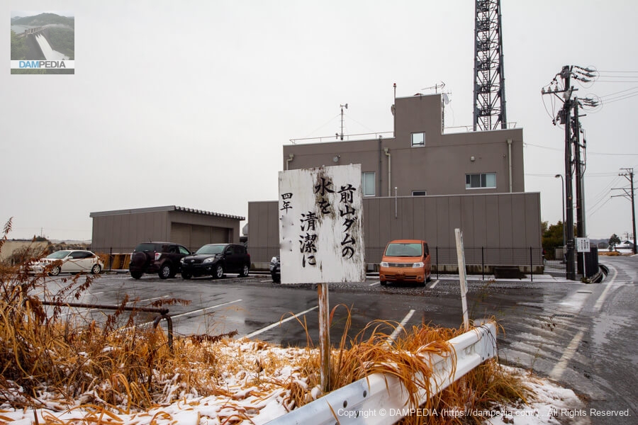
Parking lot near the left bank and top edge
Maeyama Dam has two parking lots on the left bank and one on the right bank, so it can accommodate a large number of dam enthusiasts (lol).
The mottoes in the foreground were made by local elementary school students, and many of them were placed along the surrounding roads. Local children (or rather, children in Aichi Prefecture) are taught the importance of water in the Chita Peninsula and the greatness of the Aichi Irrigation Project at school, so I am sure that they fully understand the importance of water.
Incidentally, the building in the back is the downstream management office of the Aichi Waterworks.
Looking upstream from the left bank parking lot
From the parking lot, it is a short walk to the dike. However, the road shown in the photo below is inaccessible, so you need to walk on the city road in front of it. Moreover, there is no sidewalk, so you need to be a little careful.

Flood discharge
The flood discharge is a side channel type, as is typical of earth dams and rock-fill dams. There is one through gate on the reservoir side, but since the gate is located lower than the top of the overflow weir, it appears to play the role of a permanent flood discharge. The hole on the right side of the overflow weir is probably the outlet from the gate. This is an interesting structure that is not often seen in other earth dams, but it is difficult to find much information about it.

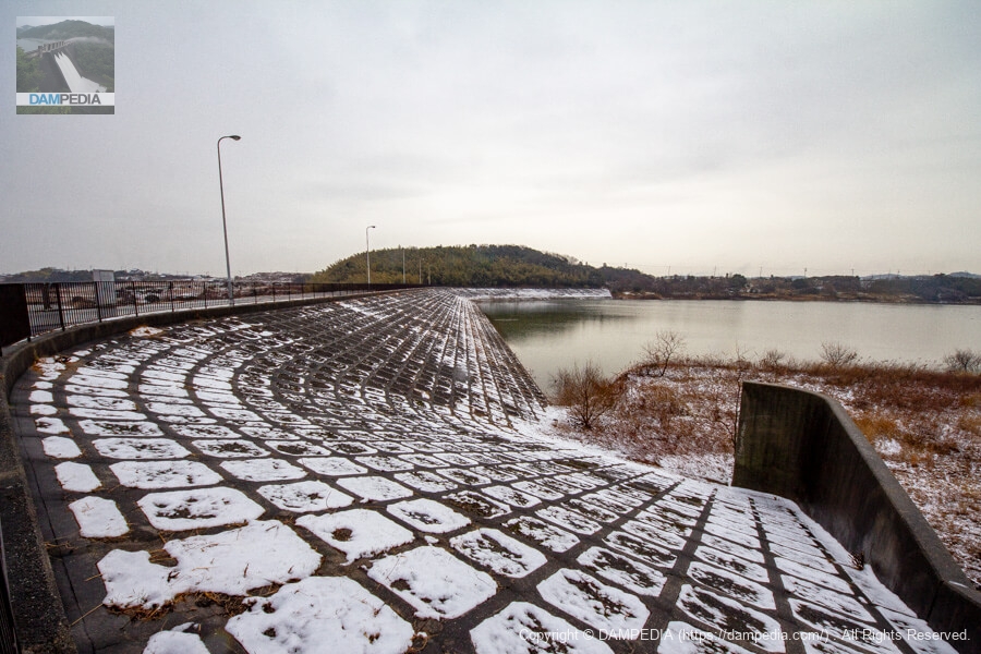
Looking upstream from the left bank
The slope is protected by concrete framing and filling.
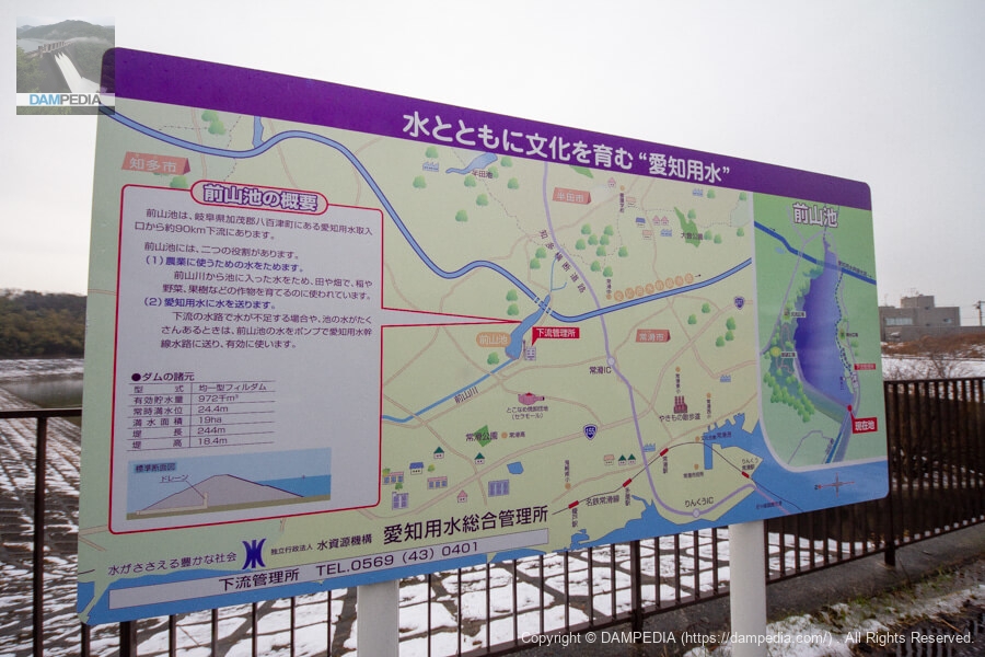
Local Signboard
This is a signboard explaining the Maeyama Dam. The name "Maeyama Pond" is used because it is more easily understood by the local people. As you can see from the diagram, the Aichi Irrigation main channel flows upstream of the reservoir, and water taken from the intake tower at Maeyama Dam is supplied to the main channel through a conduit.
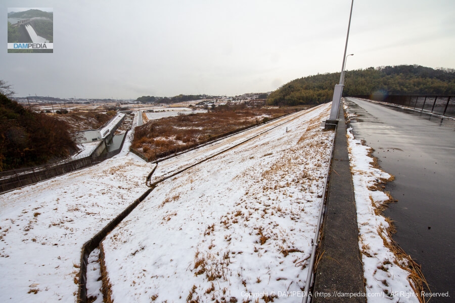
View of the top edge from the left bank
The top edge is accessible only on foot.

Looking downstream from the left bank
As expected from the Japan Water Agency management.earth damIt is a clean downstream surface. The water from the Maeyama Dam flows as the Maeyama River, which merges with the Yada River a few hundred meters downstream from the sea. The Yada River reminds us of a tributary of the Shonai River that flows through Nagoya City, but it is a different river with the same name.
Looking downstream from the right bank
For some reason, there is no fence on the downstream side, but thanks to this, you can lean out a bit to watch.
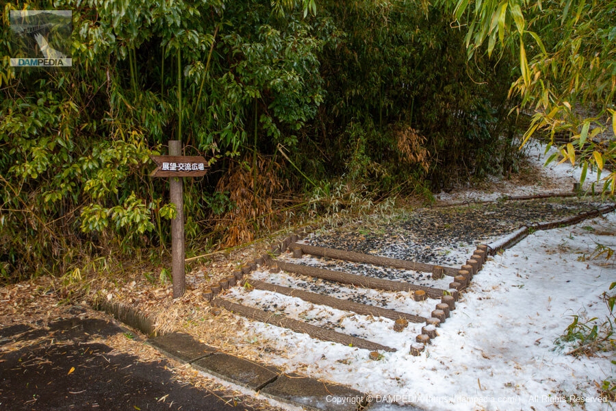
Road to the observation and exchange plaza
On the right bank is a small hill named "Observation Plaza. Upstream from the hill, there is a plaza called Koryu Hiroba (Exchange Plaza). The view from the observation deck is not so good, so we did not go that far on this day.
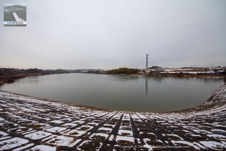
Looking upstream from the right bank
The right bank side of the embankment is built in a curved shape. The white building seen below the steel tower is an intake tower, from which water is taken to supply the Aichi water supply upstream.
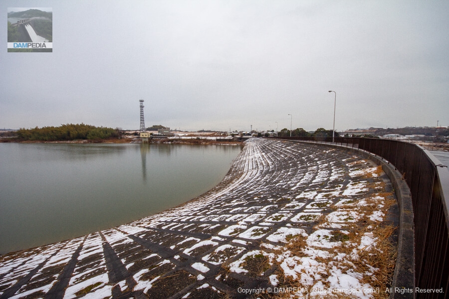
View of the reservoir from the right bank
The reservoir is not very large, but waterfowl were resting their wings. Even though it is not very large, Maeyama Dam is said to be the largest agricultural reservoir on the Chita Peninsula, with a beneficiary area of 1,103 ha, an effective storage capacity of 972,000 m3, and a crest height of 18.4 m, ranking first in all rankings of agricultural reservoirs on the Chita Peninsula. (Reference: Aichi Prefecture Chita Agriculture, Forestry and Fisheries Office reservoir ranking)
By the way, isn't the Saburi Dam (Saburi Pond) No. 1? However, the Saburi Dam is an industrial water supply facility.
The Maeyama Dam is located downstream of the Aichi Irrigation Canal and is a key site for agricultural water supply in the Chita Peninsula.
Maeyama Dam Specifications
| Location | Kanayama-cho, Tokoname-shi, Aichi |
| River Name | Yada River system Maeyama River |
| Objective | A (irrigation water) |
| Model | E (earth dam) |
| Bank height | 18.4m |
| Bank length | 244m |
| Dam volume | 136,000 m3 |
| Watershed Area | 2.1 km2 |
| Reservoir area | 19ha |
| Total storage capacity | 985,000 m3 |
| Effective water storage capacity | 972,000 m3 |
| Dam operator | Aichi Prefecture → Japan Water Agency |
| Main body constructor | Shimizu Corporation |
| Year of launch | 1977 |
| Year Completed | 1990 |
| Name of Dam Lake | Maeyama Pond |
Other facilities/observations
There are two parking lots on the left bank and one on the right bank, and restrooms are located in the park on both the left and right banks.
| Parking lot | ○ |
| Toilet | ○ |
| Park | ○ |
| PR Exhibition Hall | × |
| Fishing | × |

Comment