
Date of interview: Wednesday, 12/10/2014
Before the Tomata Dam, one of the main dams of the day, we stopped by the Tomata Saddle Dam because there was one dam we wanted to see. A saddle is a depression in a mountain ridge like a horse's saddle. When a dam is built to store water, the water flows away from the saddle, so another dam (sometimes more than one) is built at that point to dam up the water.
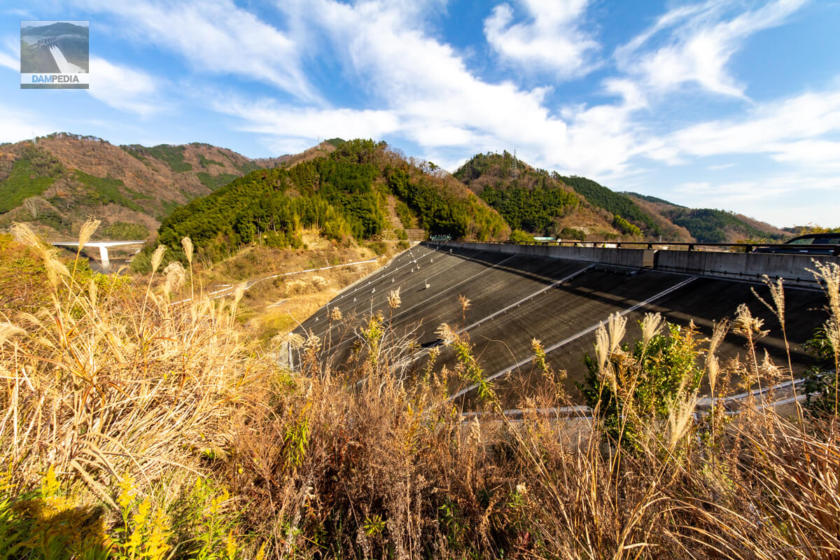
View of the downstream face of the dike
The downstream face looks like a rock-fill dam, but the upstream face is a concrete-facing fill dam with a concrete surface barrier (CFRDThe same type of dam includes the Obuchi Disaster Prevention Reservoir in Gifu Prefecture and the Ishibuchi Dam submerged by the Isozawa Dam in Iwate Prefecture. The same type of dam includes the Obuchi Disaster Prevention Reservoir in Gifu Prefecture, the Ishibuchi Dam, which was submerged by the Isawa Dam in Iwate Prefecture, and the Notan Dam in Gunma Prefecture. The cross-shaped arrangement of boulders on the riprap is said to be inspired by the labyrinth-type flood discharge of the Tomada Dam.

Looking a little closer at the downstream face of the dike
We are looking up the ramp-like passageway seen on the right in the photo above.

Downstream face at close range
There are boxes with doors here and there on the dike, which appear to be various measuring devices.

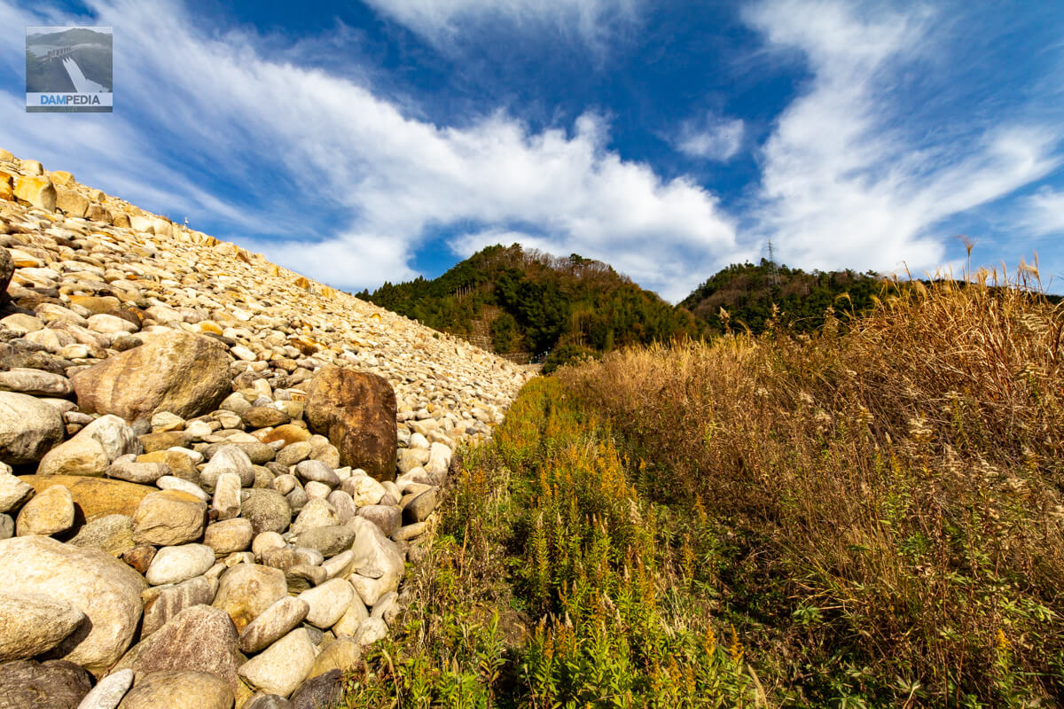
Downstream face of the left bank side of the embankment
Because it is a saddle dam, there is no flood discharge or other gates, and the river is not flowing.left bank (of a river)"right bank (shore)Although it may seem a little different to describe them as "left bank" and "right bank," for the sake of convenience, we refer to the right bank as the left bank and the left as the right bank when viewed from the downstream face.
On the left bank side, the slope of the embankment seems to gradually narrow as the land immediately approaches.
Downstream face of the right bank side embankment
Although the embankment is small, with a height of 25 meters, it is powerful when viewed from directly below.

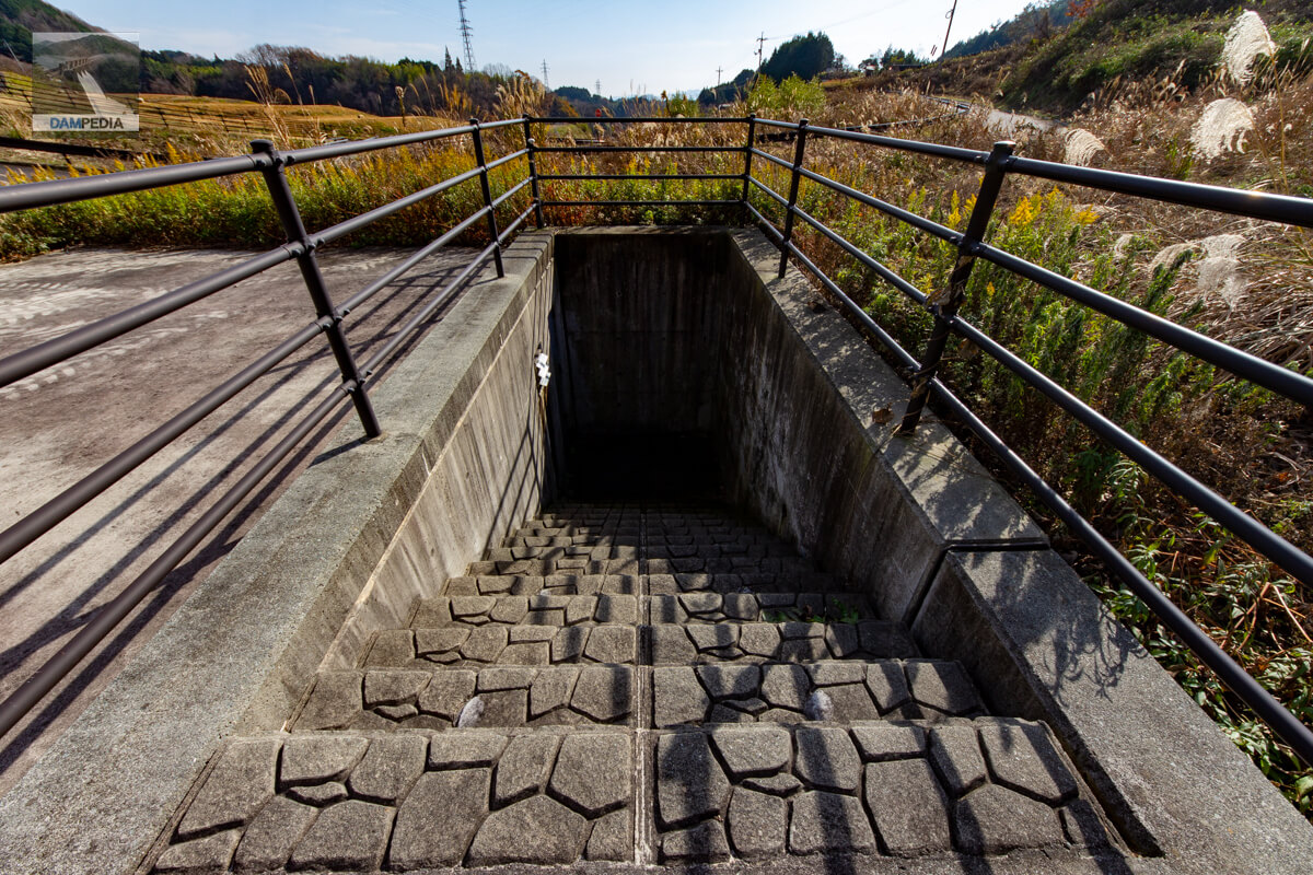
Audit corridor?
Directly below it is a concrete structure that appears to be the entrance to an audit corridor. However, none of the drawings show anything that looks like an audit corridor, so I think it may house seismometers, leakage gauges, or other measurement equipment.
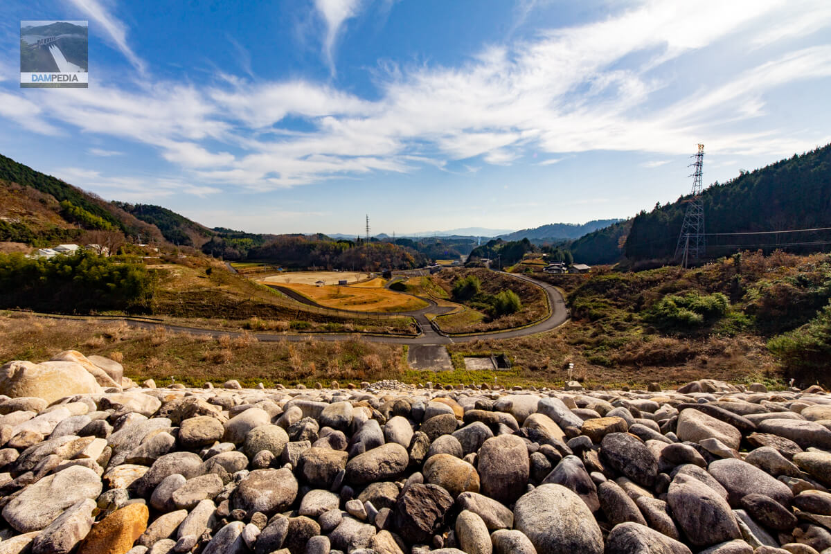
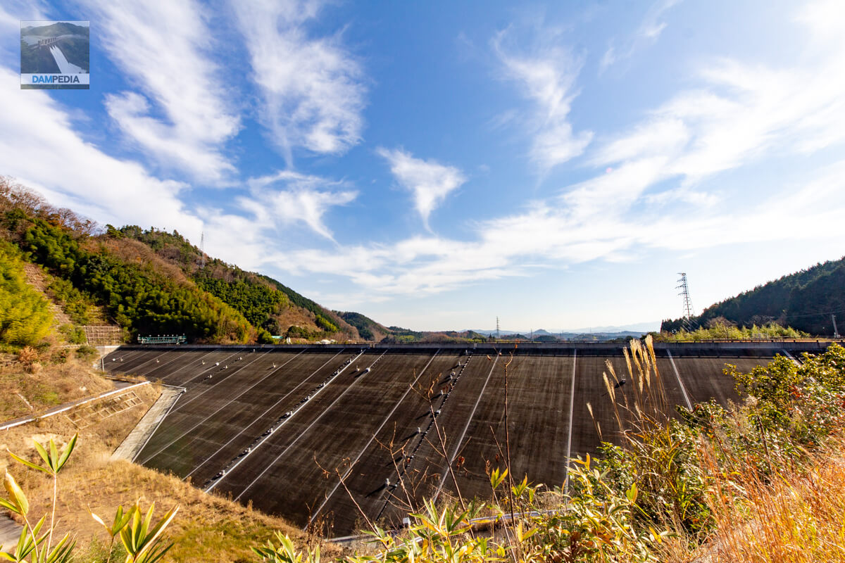
Looking downstream from the right bank
We came from the road on the right bank side to the top edge level. It had been nine years since its completion at that time, but the riprap looks beautiful in this way.

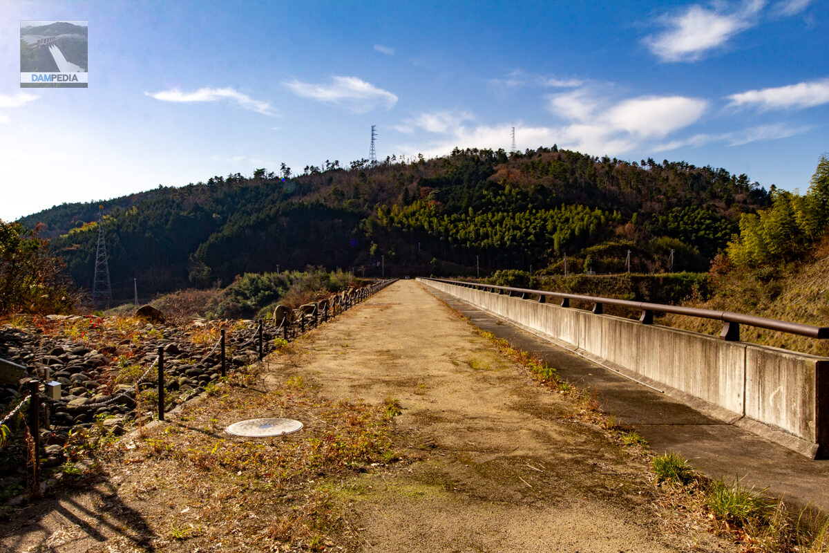
View of the top edge from the right bank
The top end dead-ends at the left bank and is closed to vehicular traffic. Also, although it is unpaved, the upstream side, which is concrete for the CFRD, has a raised parapet wall. In contrast, the downstream side, like most rockfill dams, has poles and chains to prevent entry into the riprap, but it is open.
At the entrance to the top edge, a blue tag with the words "pathway for management" is hung on a chain. For a moment, I thought it was off-limits, but I could not understand why this tag was hung on the chain, whether only the upstream side was a pathway for management or whether it was an appeal that "the top edge is not just a road".

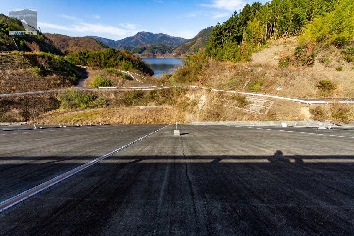
Looking downstream from the top
Downstream is a park called Kagamino-cho Tsukadani Athletic Park, which has a parking lot.
Slipform for main slab
This is actually a machine called a slipform that was used during the construction of the Tomata Anbu Dam to construct the main slab of the CFRD and is displayed on the left bank.
Slab is a construction term for a slab constructed of reinforced concrete. Slipforms are mobile formwork that can be continuously poured while moving across the slope.
There is no need to construct or remove formwork, and because concrete is placed while moving, the speed is fast, and in addition to saving labor and manpower, the construction period can be shortened, making this a construction method that is also friendly to the wallet.
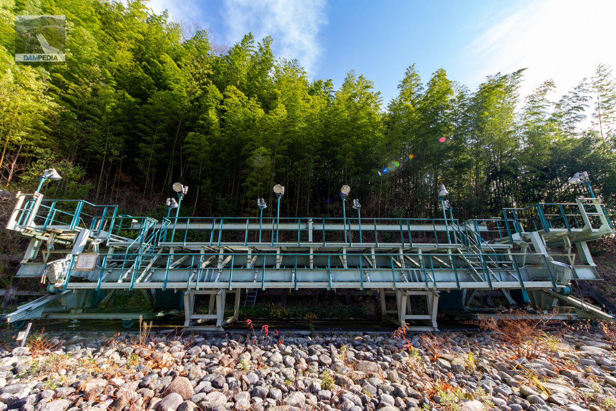
Slipform Specs
It contains the specifications for that slipform.

View of the top edge from the left bank
CFRD takes the best parts of the imperviousness of concrete and the environmental and economic performance of rockfill, but even looking at the top edge like this, it is interesting to see that it is half rockfill and half concrete (though not really half).
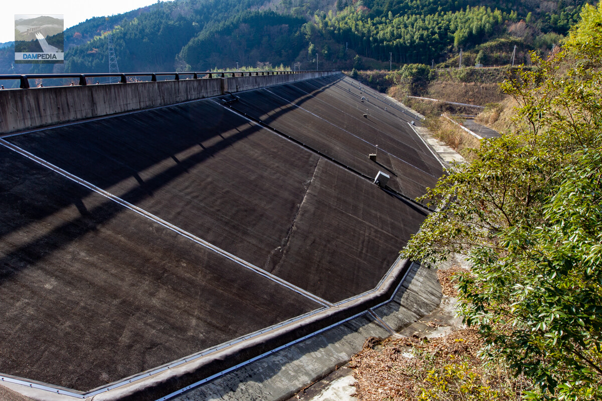
Looking upstream from the left bank
There were only a few examples of CFRD construction in the 1950s, including the Obuchi Disaster Prevention Reservoir (completed in 1951), Ishibuchi Dam (1953), Nozori Dam (1956), and Minase Dam (1963), but because of the stone throwing method used at the time, the embankment was easily deformed and leaks often occurred due to face slab damage. The face slab was often damaged, resulting in frequent leaks. In addition, the fact that there were many joints at that time because the concrete was cast in the form of blocks also seems to have been a factor in the leakage.
Later, compaction with vibratory rollers became common, making the embankment less prone to deformation, and the development of the slipform method eliminated horizontal joints, thereby reducing leakage.
For this reason, CFRDs have been attracting attention again in recent years, and the fact that they are not usually immersed in water seems to have been a deciding factor in their adoption at the Tomata Anbu Dam.
Looking upstream from the top
Measuring devices are placed here and there on the dike face, indicating that careful inspections are being conducted. The one on the left in the photo is a surface deformation measuring device, and the one in the center is a target for measuring external deformation (movable target).
Looking upstream from the right bank
As a result of careful inspection during the test waterlogging, the amount of leakage, seepage, top end settlement, and slab deformation was very small. The amount of leakage, seepage, settlement of the top edge, and deformation of the slab were quite small compared to CFRDs overseas, which may be a result of Japan's technological capabilities.
View of the downstream face of the dike
From this vantage point, the view is hard to believe that this is a rock-fill dam. The Tomata Anbu Dam was the first modern CFRD to be constructed in Japan, so it was not the main dam like the Tomata Dam, but a subsidiary dam with a small embankment and a gentle slope of 1:2.0. (Incidentally, in a real sense, the Tokuyama Dam's secondary closure was the first modern CFRD to be constructed, but of course it does not exist today.)
Based on this construction case and its results, the adoption of a CFRD with a larger and steeper gradient will be considered in the future. In fact, as of 2022, the Nanma Dam being constructed by the Japan Water Agency in Tochigi Prefecture will adopt the CFRD, with an embankment height of 86.5 m and a slope of 1:1.805 upstream and 1:1.90 downstream, making it larger and steeper than the Tomata Anbu Dam.
Although it stands quietly in the shadow of the massive and visually stunning Tomata Dam, the Tomata Anbu Dam is a milestone in modern CFRD and may well influence subsequent dam construction in Japan and the world.
reference data
- Safety management of seepage/leakage and external deformation of Tomata saddle dam (CFRD)
- One of the largest CFRD (surface barrier rockfill dam) in Japan, the Nanma Dam, is under construction!
- Construction of Concrete Surface Intercepting Rockfill Dam (CFRD) -Case Study of Ponle Ponle Dam, Indonesia-.
- Design, construction and behavior observation of the Pont-Répont-Répondre Dam (CFRD)
Tomata Anbu Dam Specifications
| Location | Tsukadani, Kagamino-cho, Tomata-gun, Okayama |
| River Name | Yoshii River System Yoshii River |
| Objective | F (flood control, agricultural disaster prevention) N (unspecified water, water for river maintenance) A (irrigation water) W(Water for water supply) I (industrial water) P(Power generation) |
| Model | R (Rock-fill dam) |
| Bank height | 25m |
| Bank length | 259m |
| Dam volume | 180,000 m3 |
| Watershed Area | - km2 |
| Reservoir area | - Ha. |
| Total storage capacity | - m3 |
| Effective water storage capacity | - m3 |
| Dam operator | Chugoku Regional Development Bureau |
| Main body constructor | Taisei Corporation |
| Year of launch | 1972 |
| Year Completed | 2004 |
| Name of Dam Lake | Okutsuko (Lake Okutsu) |
Other facilities/observations
The restrooms are in Tsukadani Park, and the PR exhibition hall is in the exhibition room attached to the Tomata Dam Management Office.
| Parking lot | ○ |
| Toilet | ○ |
| Park | ○ |
| PR Exhibition Hall | ○ |
| Fishing | ○ |
| Viewing platform | × |
Map of the Tomata Anbu Dam area
Weather around Tomata Anbu Dam
Accommodations that may be close to Tomata Anbu Dam

Comment