
Date of interview: Sunday, 04/20/2014
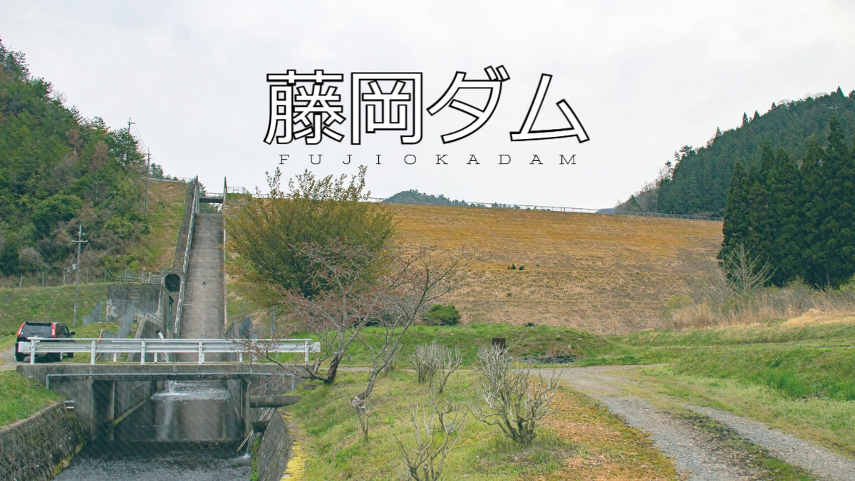
Fujioka Dam is a rock-fill dam for irrigation in Tambasasasayama City, Hyogo Prefecture, and is one of four dams (Sanaka Dam, Fujioka Dam, Tsubakuichi Dam, and Hachimantani Dam) constructed as part of a prefectural irrigation and drainage project as part of a Sasayama River coastal land improvement project. It is the only rockfill dam with a large embankment.
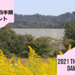
View of the downstream face of the dike
It is a little dark because of the early morning and cloudy sky.
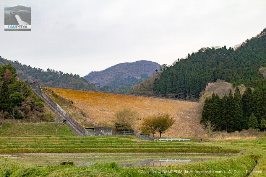
It is a center-core rockfill dam, but from a distance it looks like an earth dam. Downstream, rice paddies spread out, creating an idyllic atmosphere.
Let's get even closer to the levee.
Even up close, it looks like a neatly mowed earth dam itself. It does not look like a rock-fill dam at all.
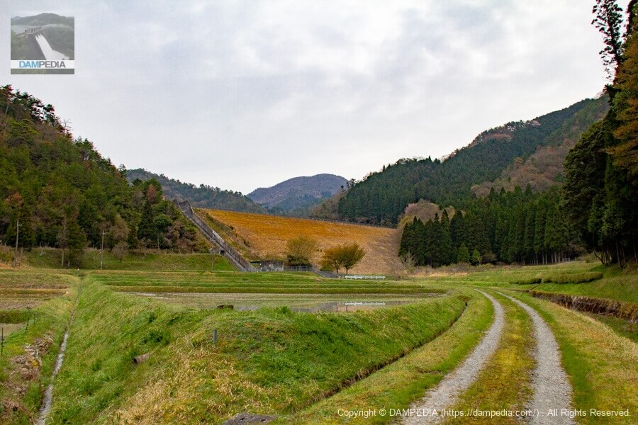
Looking downstream from just below the levee
I thought I could see a part that looked like a rock-fill dam if I got even closer, but it still looked like an earth dam.
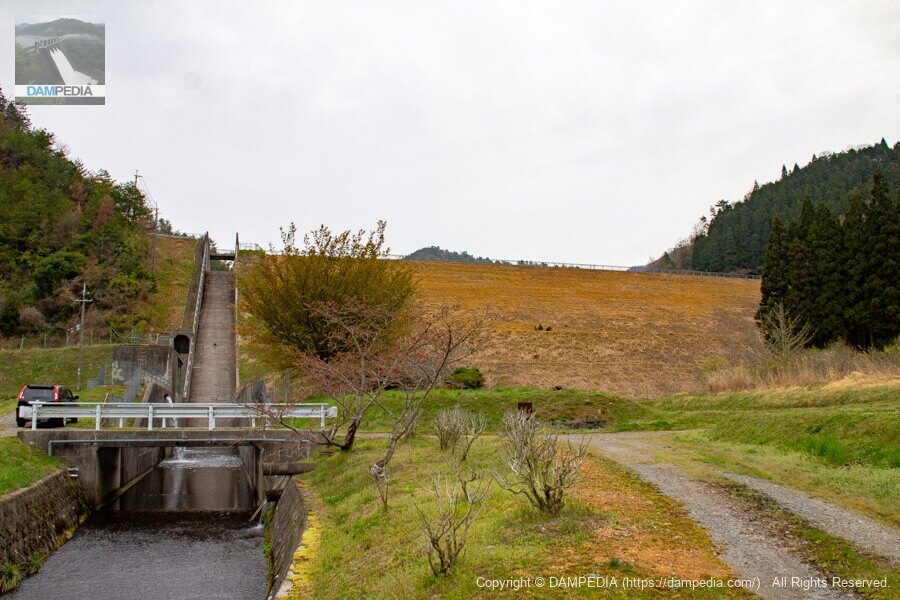
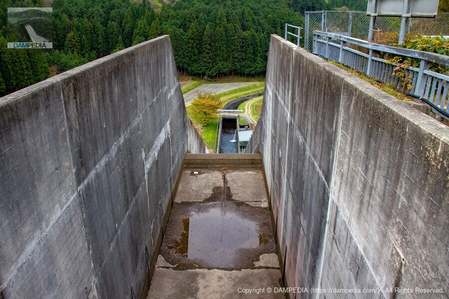
View of the conduit from the bridge downstream
The flow-conducting wall is constructed in a larger size. There are earth dams with flow-conducting sections of this size, but it may be said that the rockfill dam-like appearance can be found in the flow-conducting section.
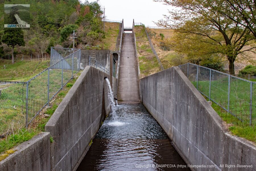
Looking downstream from the bridge downstream of the dike
The Fujioka Dam was built on the Fujioka River, which flows through rice paddies filled with water just as it is time for rice planting.
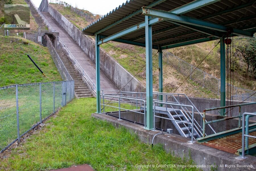
Equipment located by the side of the conduit
Mysterious equipment by the downstream conduit. Could it be a valve for river maintenance or a facility for diverting water for agricultural use? Furthermore, there is an entrance that looks like an audit corridor in the middle of the conduit. The local signboard shows a cross-sectional view, but there is no indication of an audit corridor there, so it is a bit of a mystery.
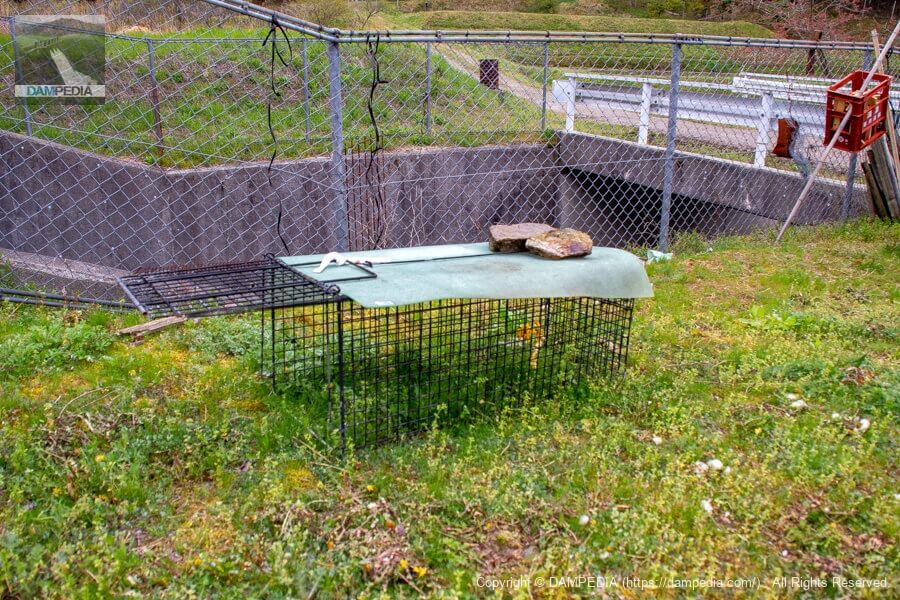
snare
As a side note, there was a trap set downstream of that facility. The area seems to be plagued by animal damage.
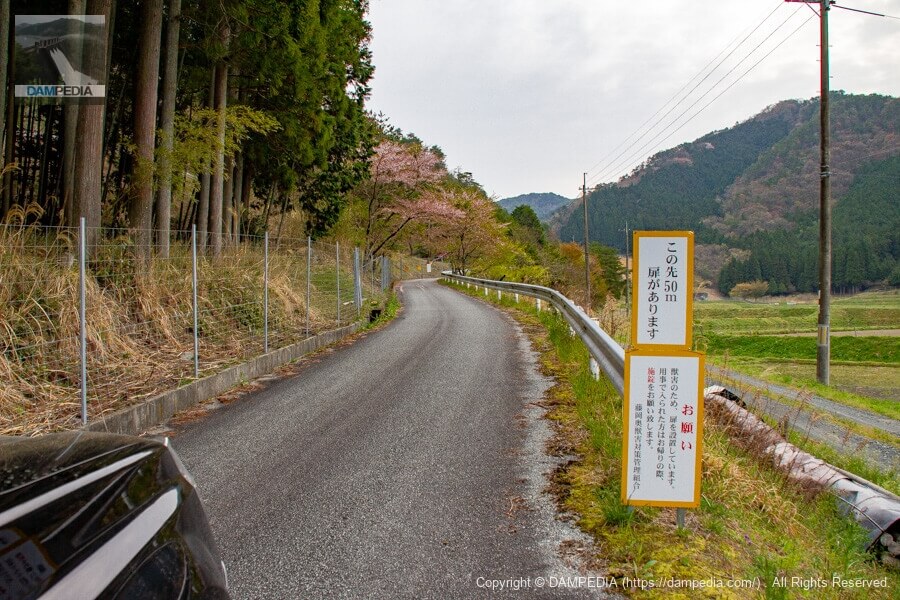
Path from downstream to the top of the river
Further downstream, on the road to the top edge, there is a door for animal fencing that can be opened and closed freely. Remember to lock the door when you leave.
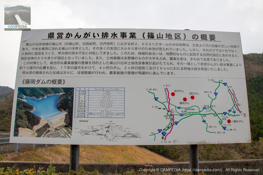
Prefectural Irrigation and Drainage Project (Sasayama District) Outline Sign
This signboard shows the outline of the prefectural irrigation and drainage project and the Fujioka Dam. It is a large and splendid sign. It is easy to see the location of the four dams related to the project (Sanaka Dam, Fujioka Dam, Tsubakuichi Dam, and Hachimantani Dam). The Sasayama River is not depicted on the map, but it flows east to west through the center of Tamba Sasayama City in the basin (in the middle of the map). Mountains stretch to the north and south across the Sasayama River, but it seems that the city had difficulty securing water.
Looking downstream from the bridge at the top
It is quite deep. The chute section is slightly ahead of the bridge, so it is not visible from the bridge as a blind spot. There is a step just before the chute to reduce the momentum of the water flow.
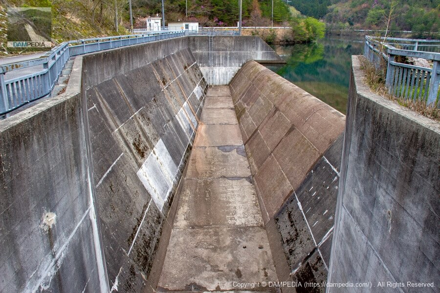
View of the spillway from the bridge at the top
The spillway discharge is a side channel system. The overflow embankment is also large. I would like to see the overflow.
Prefectural Irrigation and Drainage Project Sasayama River Coastal District Monument to Commemorate the Completion of the Project
A magnificent stone monument. Perhaps because this is the newest dam among the prefectural irrigation and drainage projects in the Sasayama River coastal area, the stone monument is also beautiful.

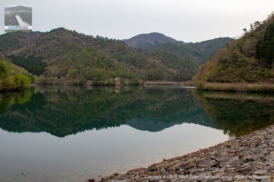
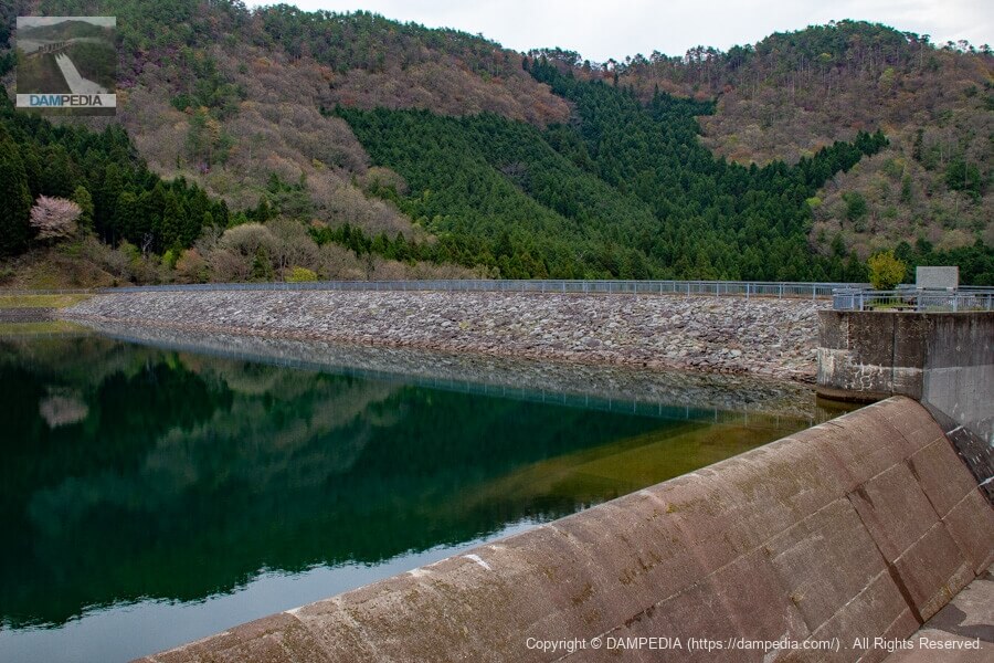
View of the reservoir from the top
Like the Tsubashi Dam, this reservoir is quiet and clean, probably because there are no houses upstream.
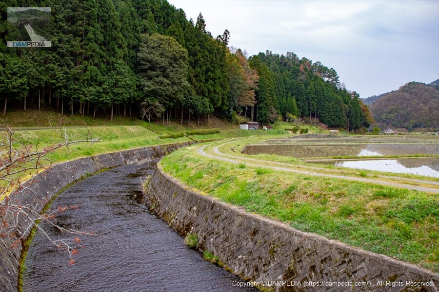
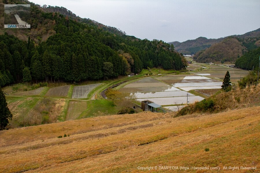
Looking downstream from the top
Downstream, one can clearly see rice fields spreading along the Fujioka River. Still, even from here, the embankment looks like an earth dam.
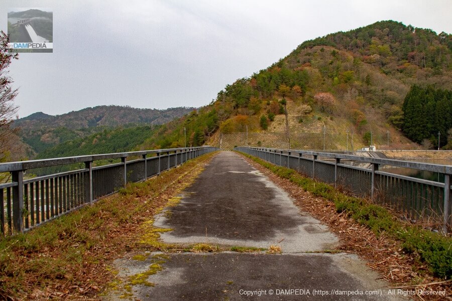
View of the top edge from the left bank
The top edge is closed to vehicular traffic due to the presence of a car stop.
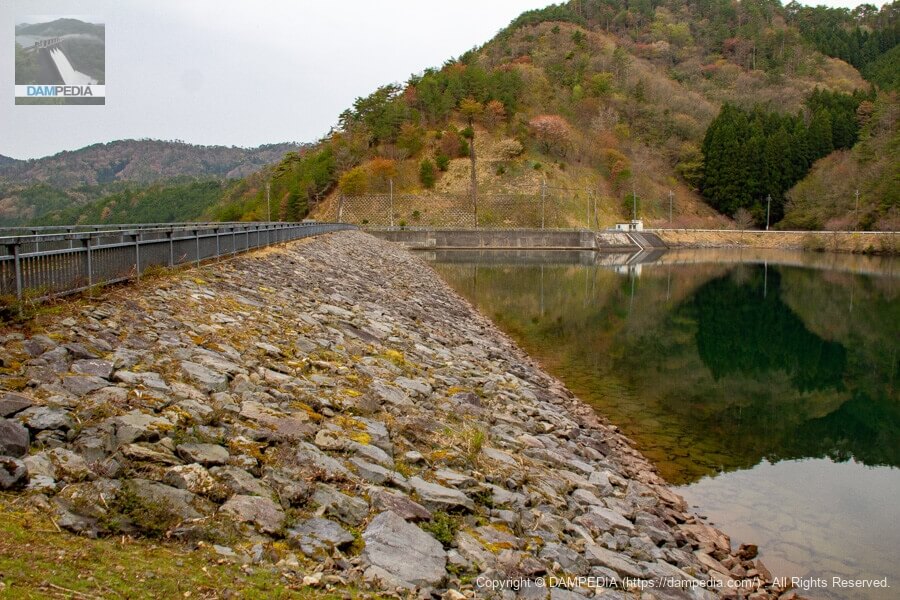
Looking upstream from the left bank
Even though the upstream face had some grass growing through the rock material, it did not look as earthy as the downstream face, indicating that it was unmistakably a rockfill dam.
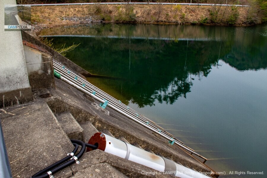
View of the right bank spillway and slant-flume intake system from the top
On the left is the residual water discharge and on the right is the water intake facility. The intake facility has five Φ300mm and one Φ500mm sluice valves, and the maximum intake rate is 0.418 m3/s.

Slant-flume intake system
Looking at the spindle portion of the slant gutter from the side of the water intake facility building.
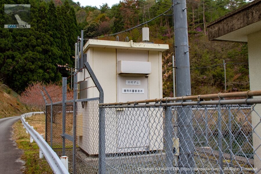
Fujioka Rainfall Observatory
There was a rainfall observatory behind the water intake facility. The name "Kawashiro Dam" refers to the intake weir located downstream of the Sasayama River. The name "Kawashiro Dam" is probably written because there is a management office there to observe and manage the data sent from the observation station.
Looking upstream from the water intake facility
The reservoir side is also a beautiful bank. The water is clear and it is a nice view.
It was the Fujioka Dam, one of the most important dams supporting agriculture in Tamba-Sasayama City.
Fujioka Dam Specifications
| Location | Fujioka, Tanba-Sasayama, Hyogo |
| River Name | Fujioka River, Kako River system |
| Objective | A (irrigation water) |
| Model | R (Rock-fill dam) |
| Bank height | 43.4m |
| Bank length | 164.6m |
| Dam volume | 362,000 m3 |
| Watershed Area | 1.9 km2 |
| Reservoir area | 8ha |
| Total storage capacity | 870,000 m3 |
| Effective water storage capacity | 784,000 m3 |
| Dam operator | Hyogo prefecture (Kinki area) (Hyougo) |
| Main body constructor | Morimoto Gumi |
| Year of launch | 1972 |
| Year Completed | 1983 |
| Name of Dam Lake | - |
Other facilities/observations
Parking would be on the shoulder of the road, etc.
| Parking lot | × |
| Toilet | × |
| Park | × |
| PR Exhibition Hall | × |
| Fishing | ○○ (excluding no-take zones) |
Map around Fujioka Dam
Weather around Fujioka Dam
Accommodations that may be close to Fujioka Dam

Comment