
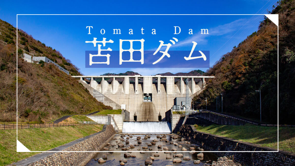
Date of interview: Wednesday, 12/10/2014
I arrived at the Tomata Dam just a short distance from the Tomata Anbu Dam. This was the eighth dam of the day. I had always wanted to visit the dam after seeing pictures taken by others, but finally I was able to see it for the first time.
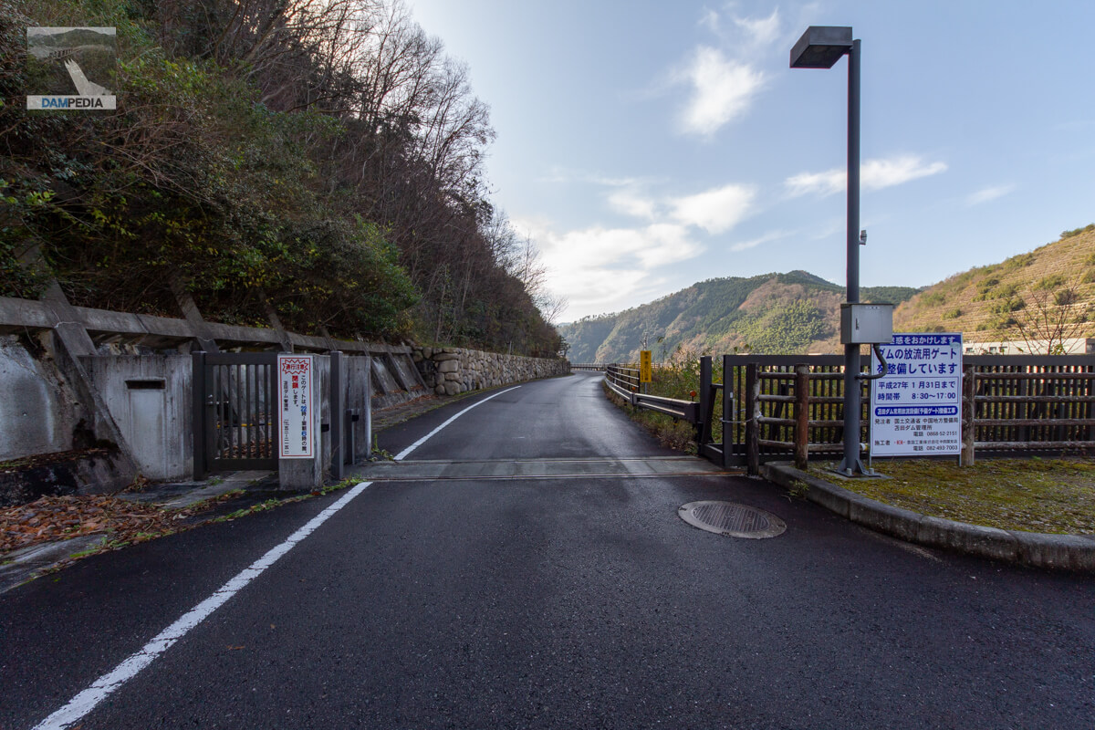
Entrance gate on left bank
The entrance gate seems to be closed from 22:00 to 6:00 the next morning. I think they are rarely there, but those who want to tour the dam starting from Tomada Dam early in the morning should be careful.
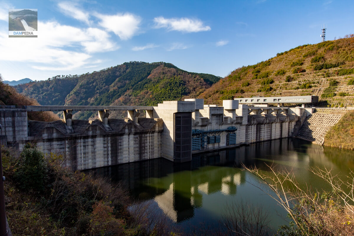
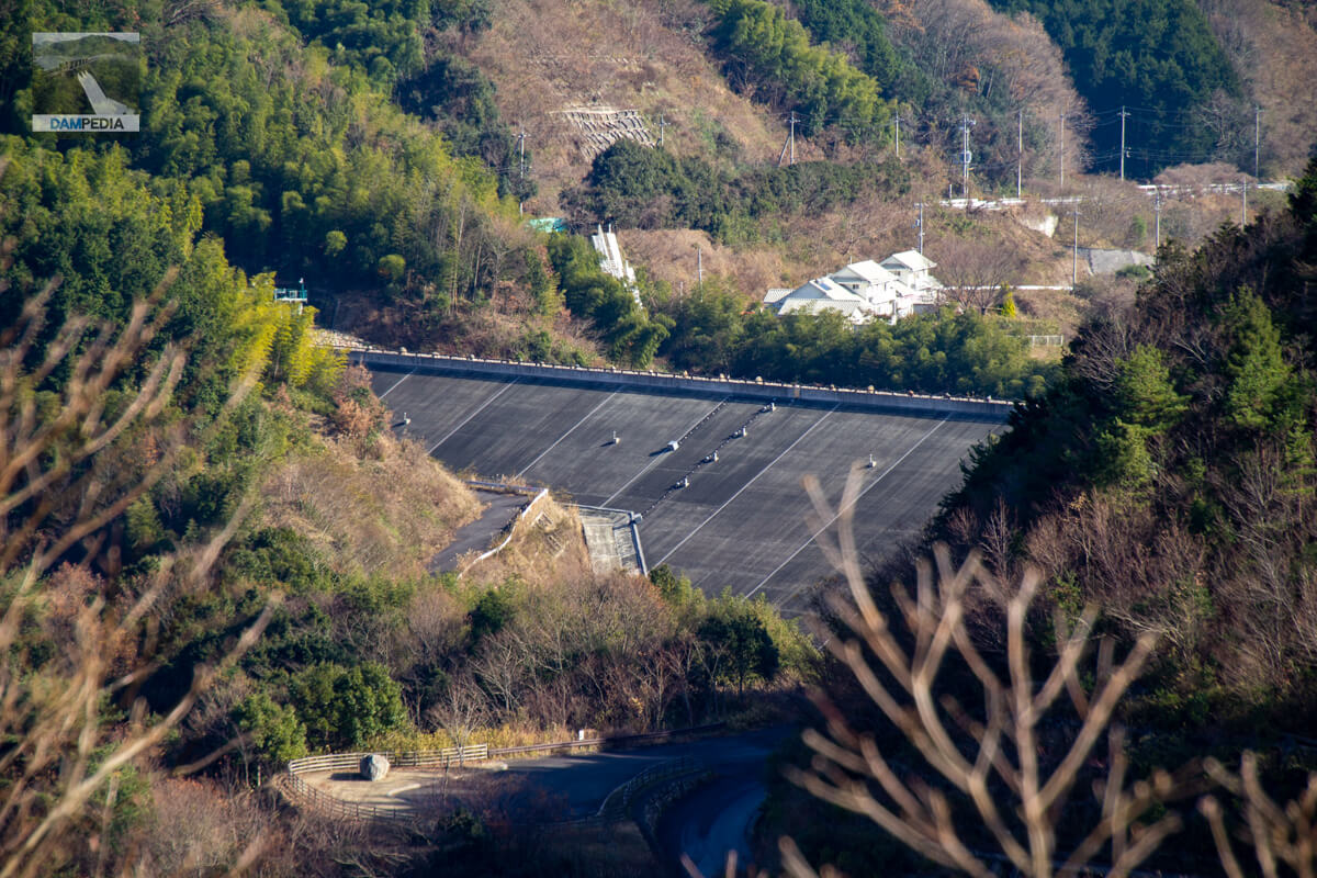
Looking upstream from the left bank
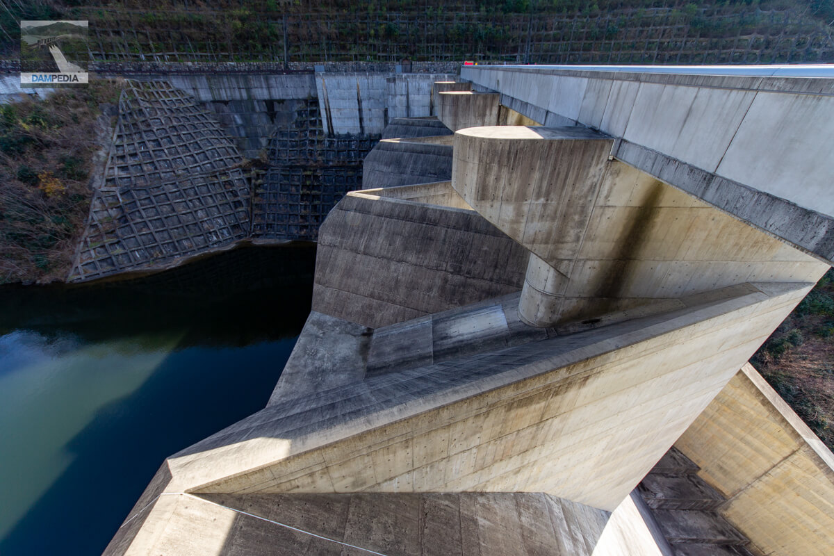
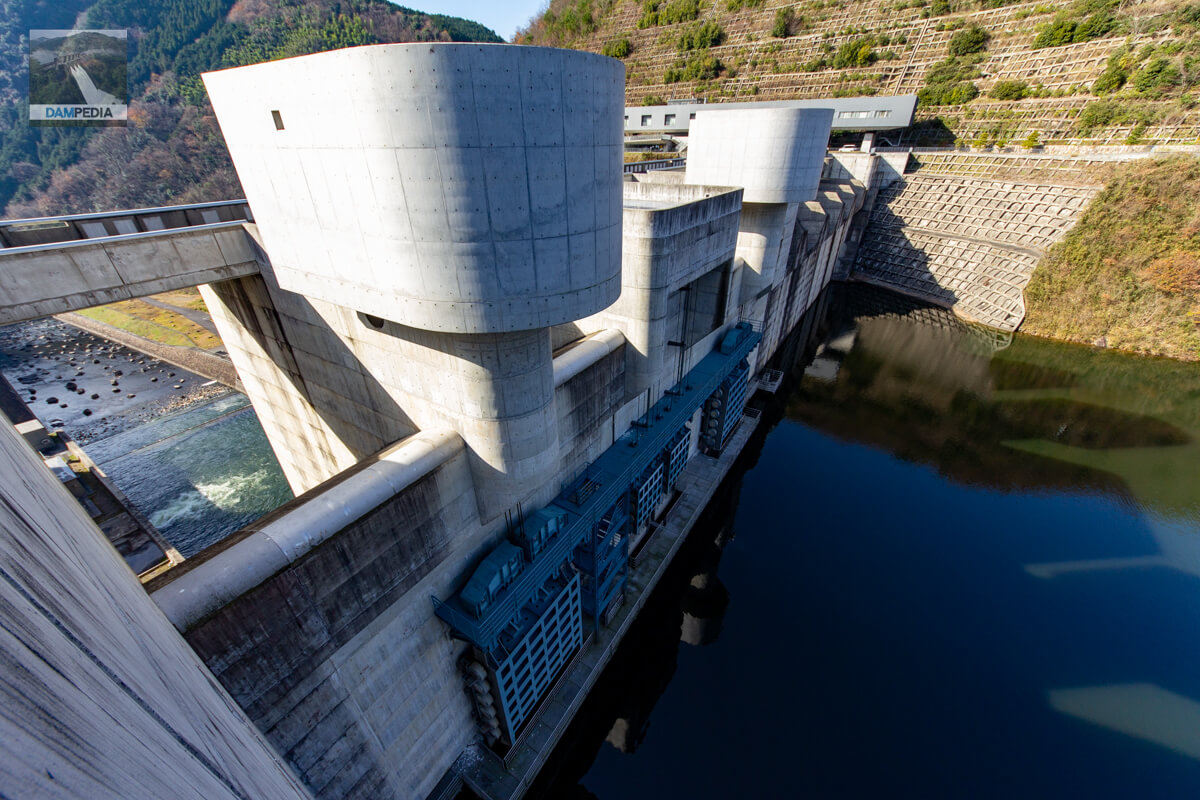
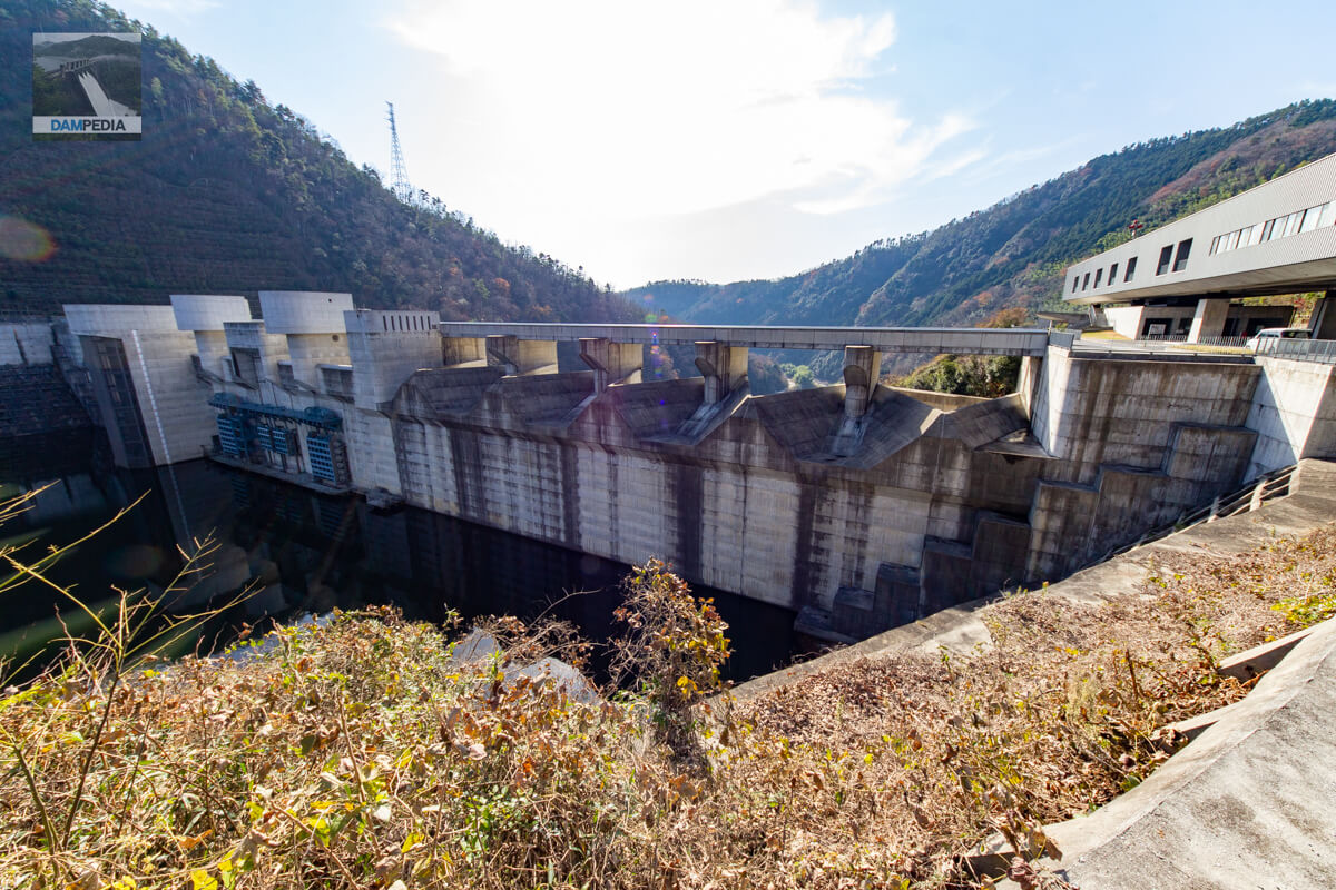
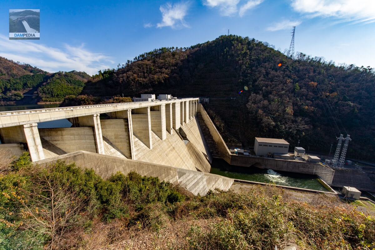
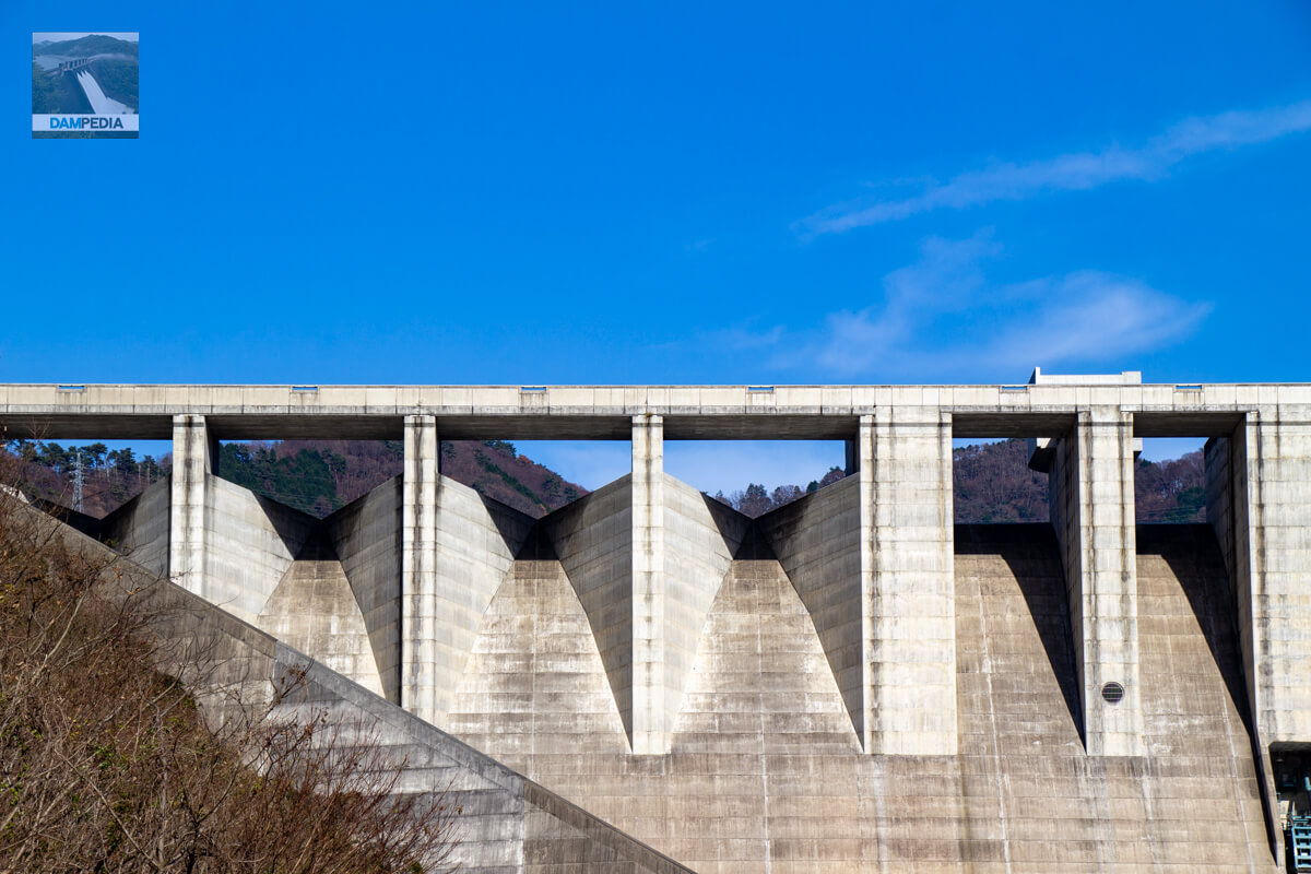
It's the culmination of the history of dams up to now! It has all the features!" This is the upstream face of the embankment. The amount of information is just too much. Labyrinth type on the left bank side from the leftFlood discharge(The system consists of a labyrinth-type free-flow overflow top (officially called a labyrinth-type free-flow overflow top), a circular multi-stage selective intake system, a reserve gate for a permanent flood discharge on the left bank, a reserve gate for a water level maintenance discharge system, a reserve gate for a permanent flood discharge on the right bank, and a labyrinth-type flood discharge on the right bank. The upper part of each reserve gate is equipped with a free overflow flood discharge that is not a labyrinth type.
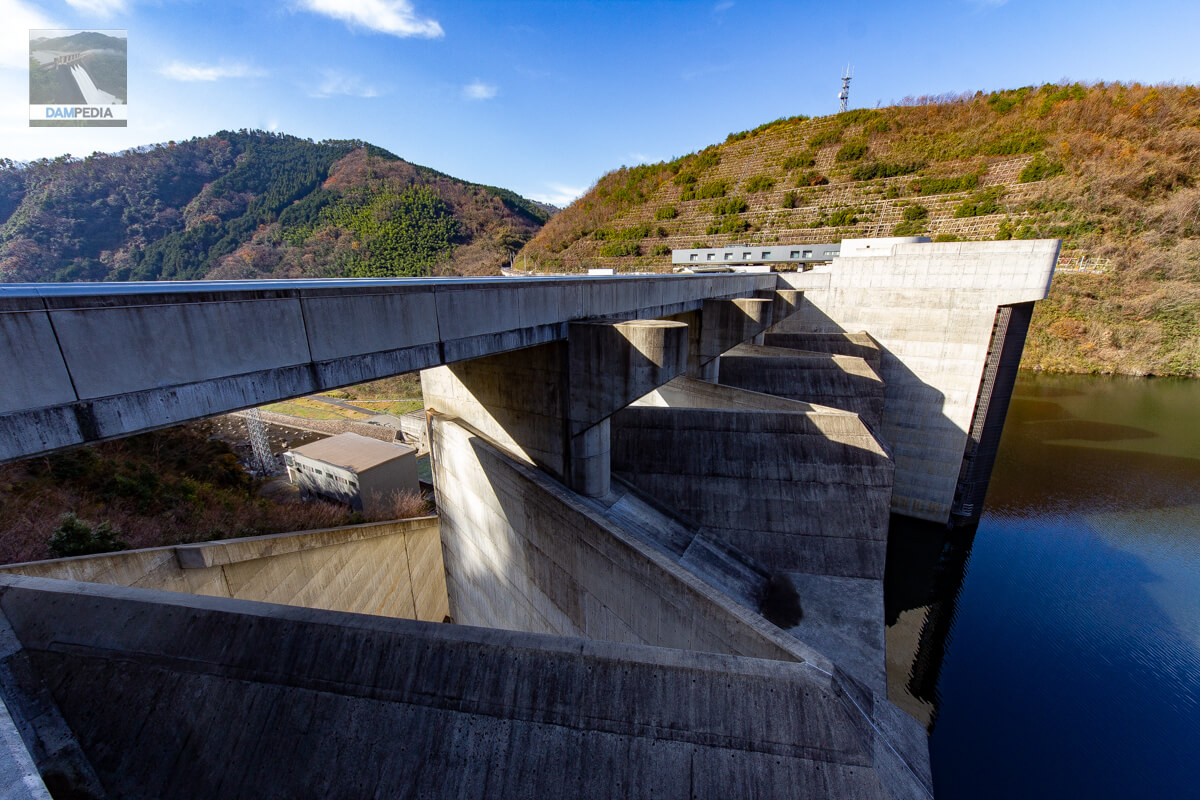
View of the top edge from the left bank
The top end is open to automobile traffic. Also, thankfully, there are well maintained sidewalks both upstream and downstream.

View of the labyrinth-type flood discharge from the left bank
The labyrinth-type flood discharge, one of the features of the Tomata Dam, was adopted because it allows for twice the overflow crest compared to a straight flood discharge, which in turn increases the discharge volume. The labyrinth-type flood discharge is the ultimate in functional beauty as well as design.
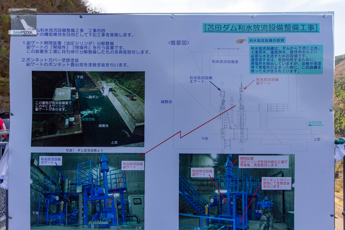
Tomata Dam water discharge facility improvement work signboard
There was a construction sign at the entrance gate that read, "The gate for dam discharge is being maintained," and this sign explained the details of the work. It was explained very clearly.
View of the labyrinth-type flood discharge on the left bank from the top of the selective intake facility
Another feature of the Tomata Dam is that it can be viewed from various angles. The labyrinth-type flood discharge can be observed from the top edge, upstream and downstream, as well as from the left and right bank sides. I would have loved to see the overflow during the test flooding.
Upper part of selective intake system
The design is very unlike a part of a dam structure. It looks like a modern building composed of concrete.
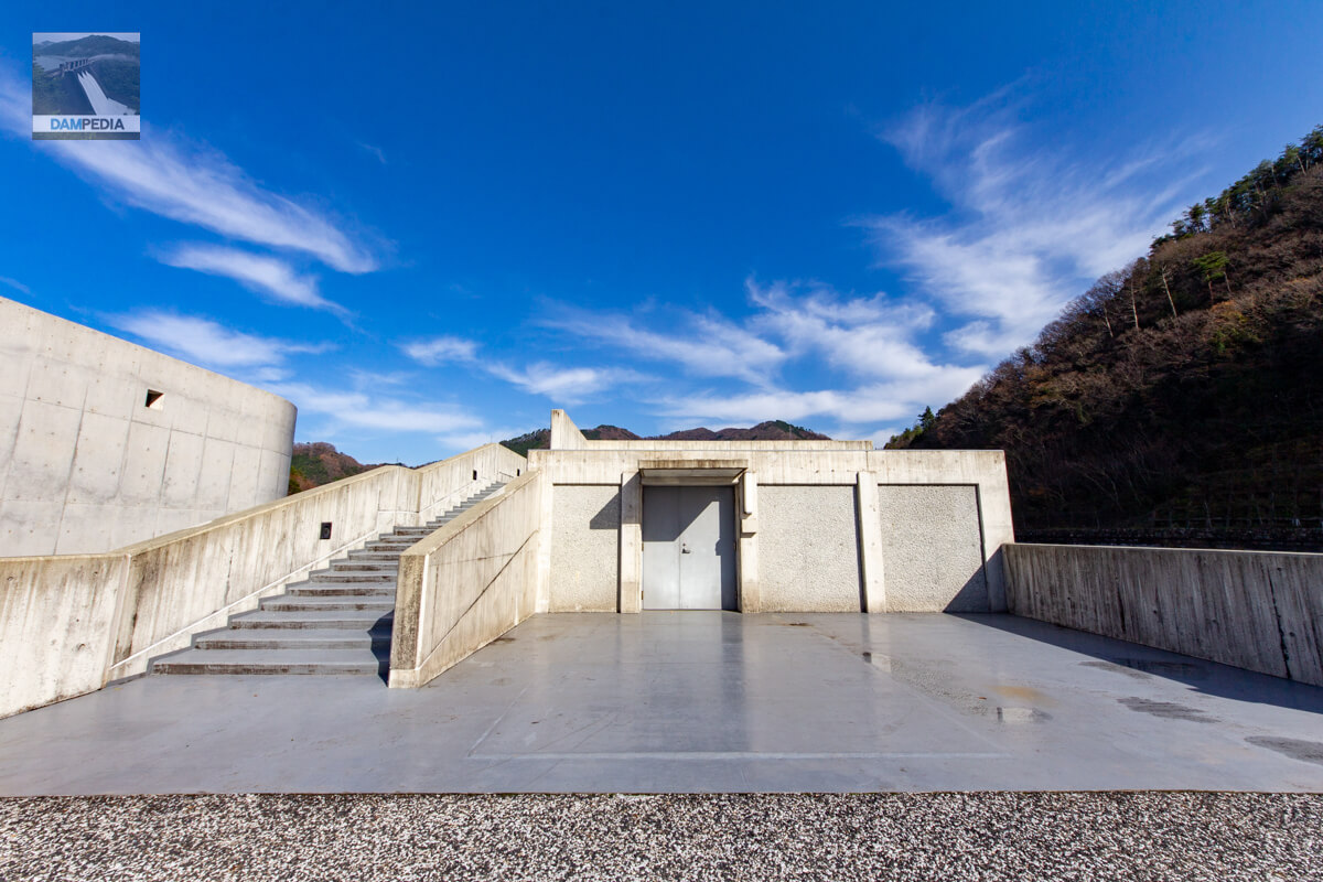
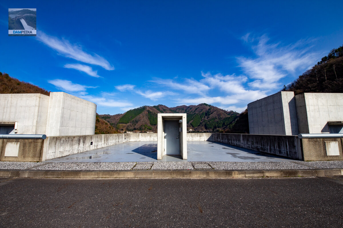
Observation platform above the selective water intake facility
Climbing the stairs next to the selective intake facility, you will find an observation deck. Because of the large size of the selective intake facility, the observation deck is necessarily large, but it is a space that is hard to find in other dams.
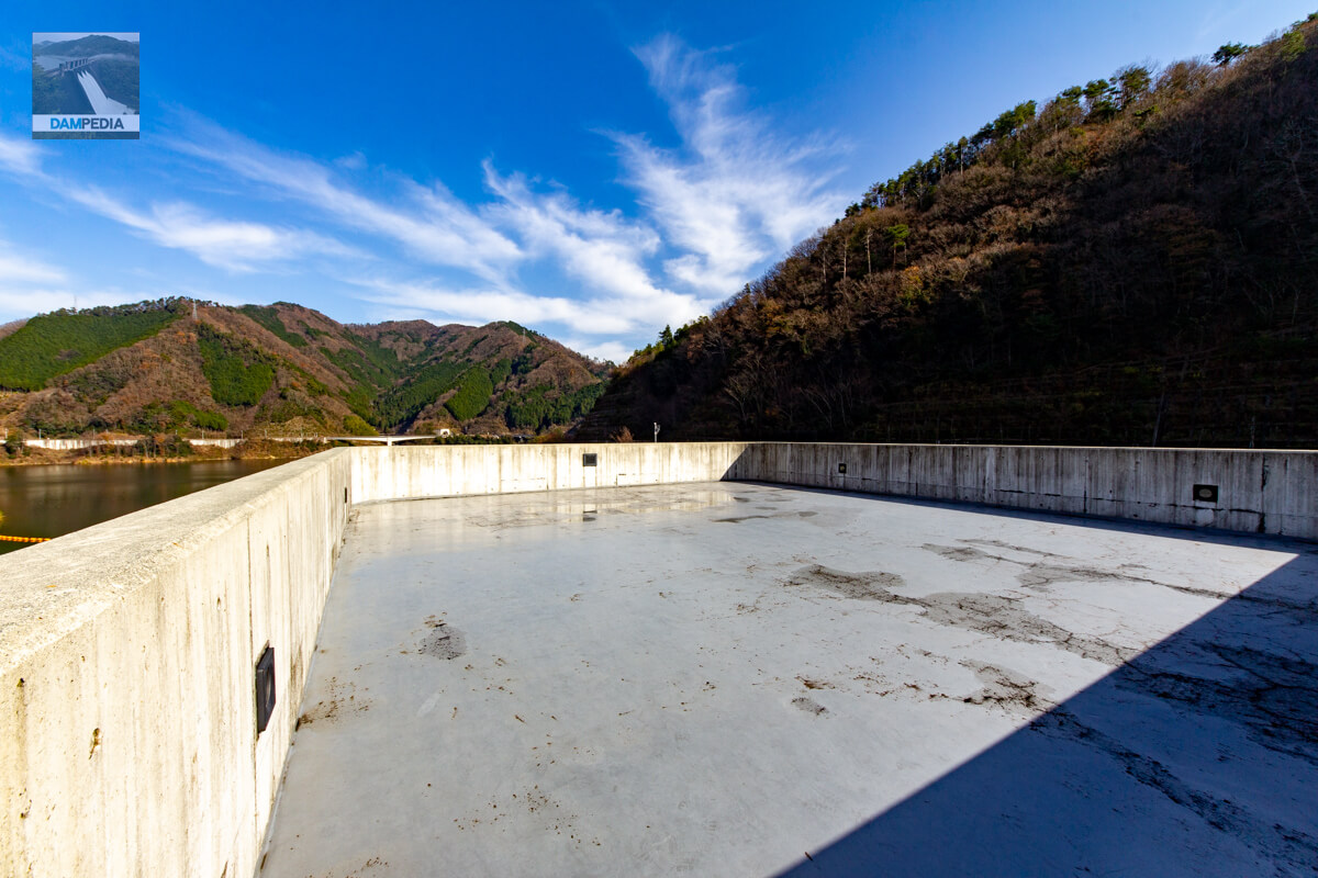
View of the reservoir from the observation deck at the Selective Water Intake Facility
The reservoir of Tomata Dam has a water area of 330 hectares, but it does not look that large from the embankment because the reservoir undulates and curves greatly.

View of the upstream side of the levee on the right bank of the selective intake facility from the observation platform
It is a nice consideration to have a good view of the upstream surface at such a close distance. It is really amazing.
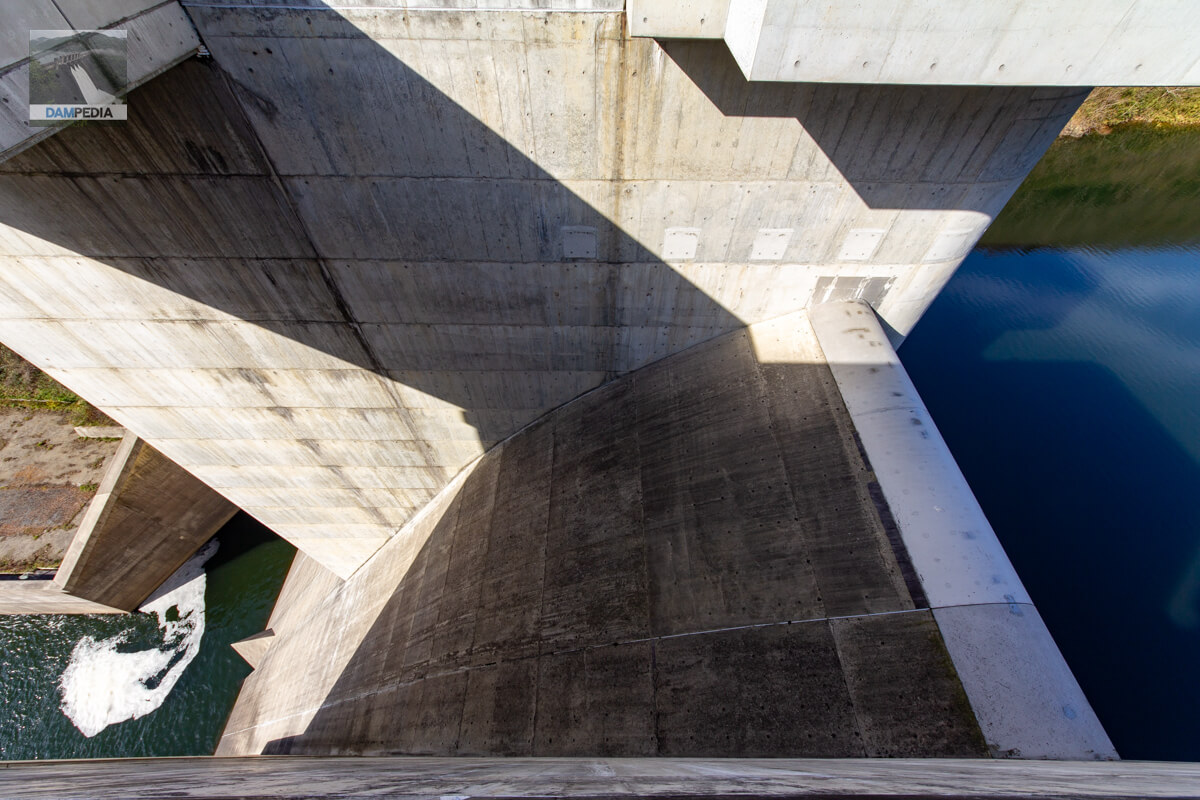
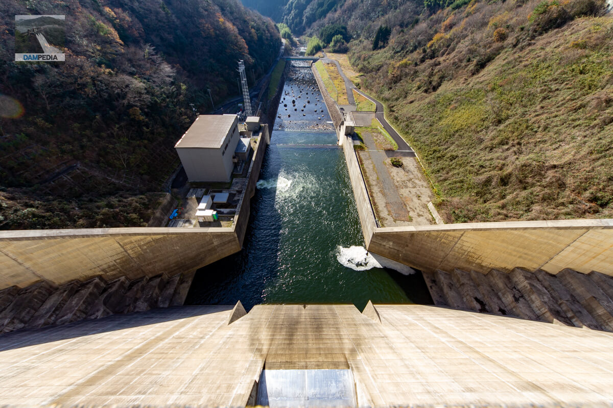
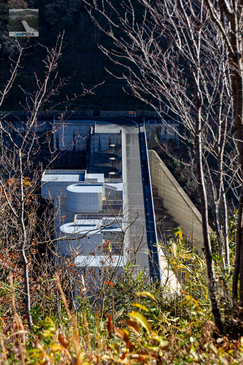
Looking upstream from approximately the center of the top edge
I was almost at the center of the top edge, above the water level maintenance discharge facility. The entrance to the audit corridor is a bit of a nuisance, but this was probably unavoidable due to the design. However, even this seems to have been incorporated into the design. If you show this photo to someone who does not know anything about dams, they will never think it is a dam.
emergency flood discharge
At the emergency flood discharge on the right bank sideordinary flood discharge(in Japanese history)conduit gateThe upper part of the deflector is located on the top of the "A" (the top of the "B"). Therefore, a triangular deflector can be seen at the bottom. Also, the emergency flood discharge at this location is not a labyrinth type but a straight type.
Entrance to the viewing corridor inside the dike
The amazing thing about the Tomata Dam is that you can visit the inside of the dam (or part of it) freely between 8:30 and 17:00.
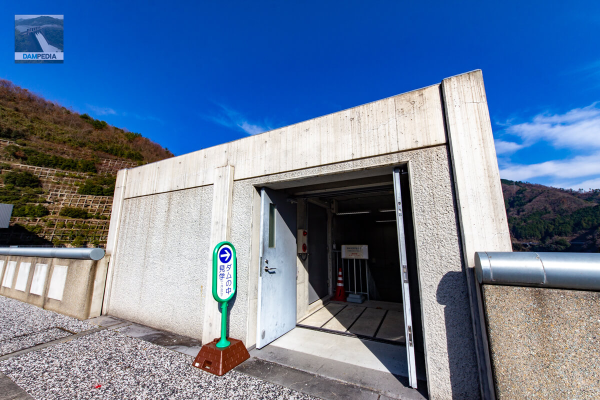
Inside of the entrance to see the inside of the dike
It is designed to go down a flight of stairs.

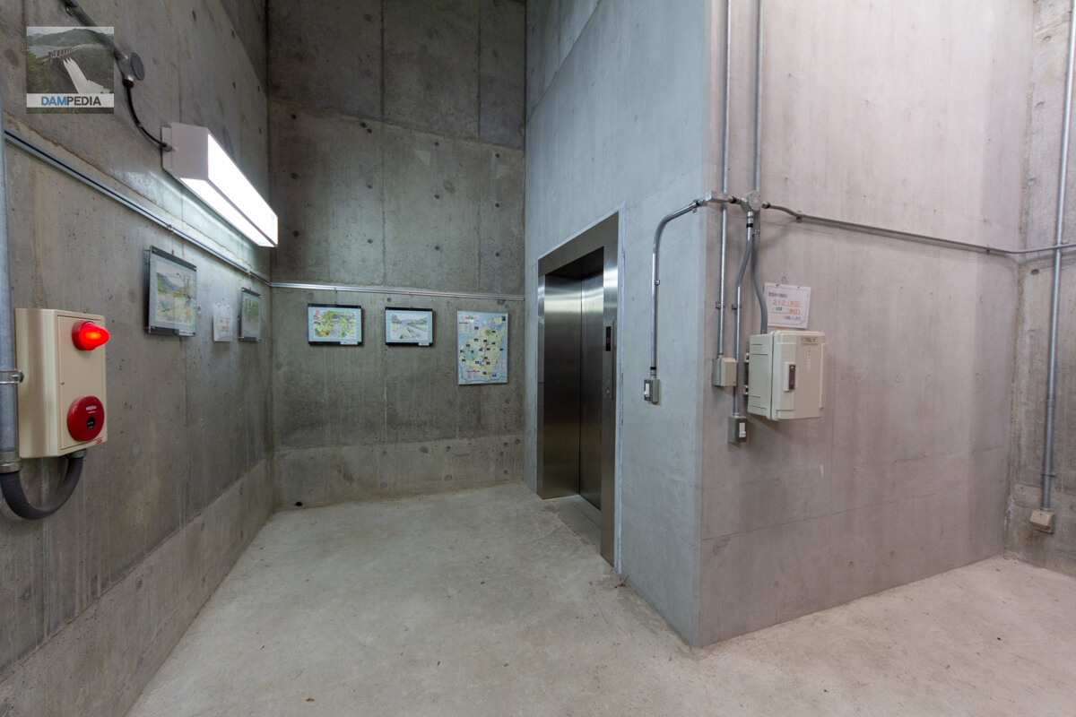
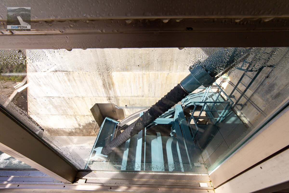
Elevator hall
Going down the stairs, the elevator hall is immediately visible. On the wall was a landscape painting that appeared to be from the local town of Kagamino.
Elevator interior
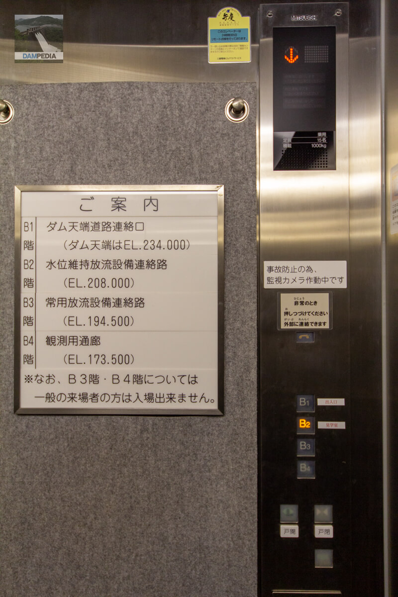
Free access to the building will be available up to the B2 floor of EL.208m.
B2F elevator hall
Since it was originally planned as a corridor for visitors, the main difference is that it is much wider than the audit corridor.

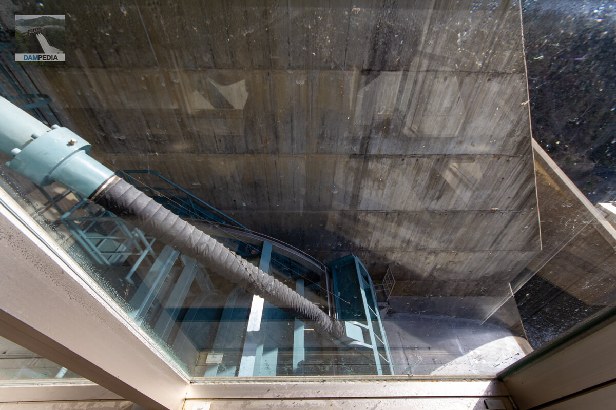
Water Level Maintenance Discharge Facility Tour Room
This kind of presentation is not often seen in other dams, and I take my hat off to the designers for thinking it through so well. I regret that it is not designed to be barrier-free. Perhaps it is difficult to secure the space. If it want to make a slope, it need to make it wider.

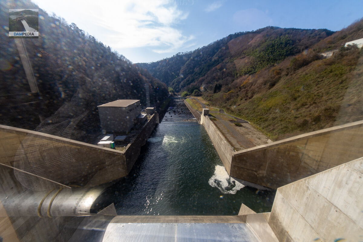
Looking downstream from the water level maintenance discharge facility tour room
The observation room has glass walls on three sides, and the front of the room looks downstream. It is as if you were the Tomata Dam yourself.
View from the tour room to the left bank
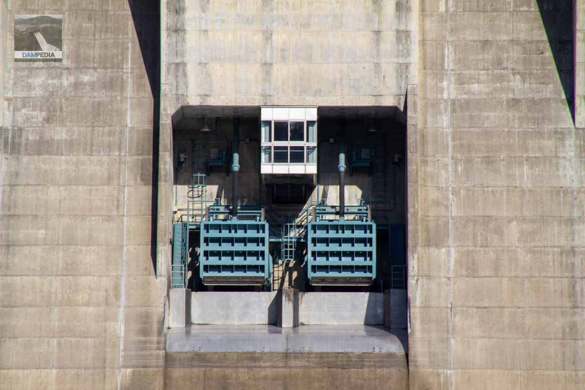
The water level maintenance and discharge system of the Tomata Dam uses a "tensile radial gate," which is different from a normal high-pressure radial gate. High-pressure radial gates support water pressure by the compressive load of the columns, but the tensile radial gate is a gate that supports water pressure by the tensile force of the columns, taking advantage of the characteristics of steel materials that are resistant to tensile force.
View of the pulling radial gate on the right bank side
The Tomata Dam has two pulling radial gates, and a viewing room is located at the upper middle of the gates so that visitors can see the gates on both sides. It is tremendously pleasing that it is designed with the general public in mind to be able to visit the site.
Looking upstream from the right bank
Although the backlighting is quite harsh in this photo, the structure of the labyrinth-type flood discharge can be clearly seen. Its upstream face also has a more complex shape than expected.
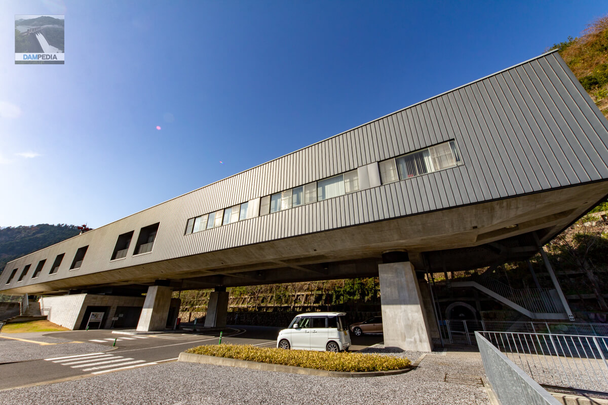
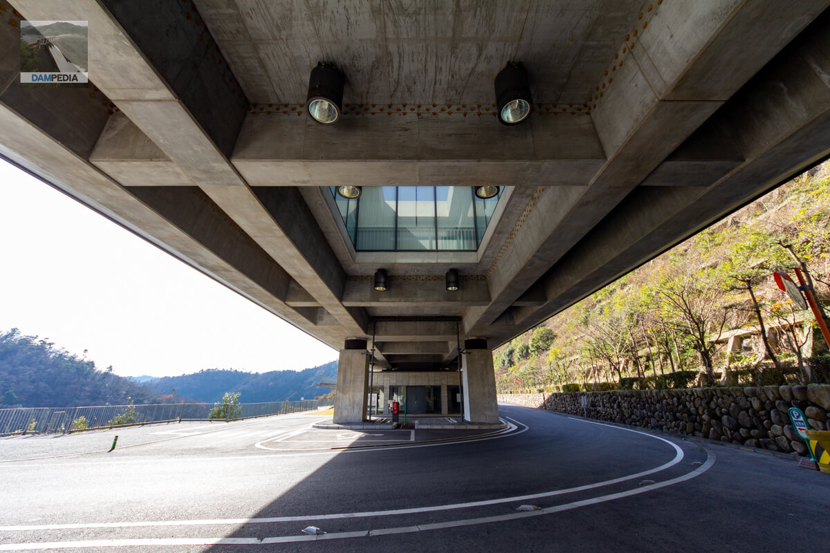
Tomata Dam management station facade
The design of this building is very unlike that of a dam management office. Designed by architect Hiroshi Naito. The first floor is a pilotis, and the entrance to the office and the Tomata Dam data room are located on the southwest side of the building. Is the seismic isolator between the pillars and the second floor part?
Management office (northeast face)
It was indeed so wonderful that I photographed the control center from various angles.
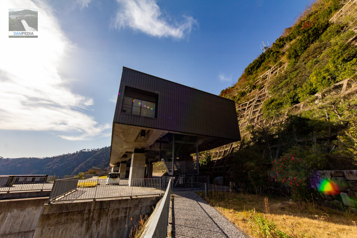
Management office (southwest face)
Although the design is composed of relatively straight lines, the southwest side is slightly hilly, which seems to bring a sense of gentleness to visitors. The rectangular control center is placed at almost a right angle to the embankment, but I felt that it was made easier for visitors to visit by angling it with the pedestrian walkway. This seems to be reflected in the slope pathway extending from the front of this photo.

Management Office Pilotis
The pilotis not only serves as a porch, but also allows the road from the top edge to pass through here. Incidentally, the middle of the building is a stairwell.
Entrance to Tomata Dam Reference Room
Visit the Tomata Dam Reference Room.

Large wrench
A large wrench was on display, although I don't remember what it was used for. Photo panels on the walls display pictures taken during construction.

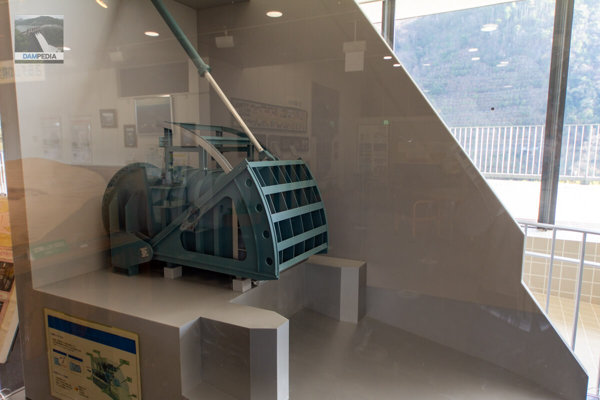
Model of tensile radial gate
Was this a driven type...? Anyway, a model of a pulling radial gate is also displayed in the reference room.
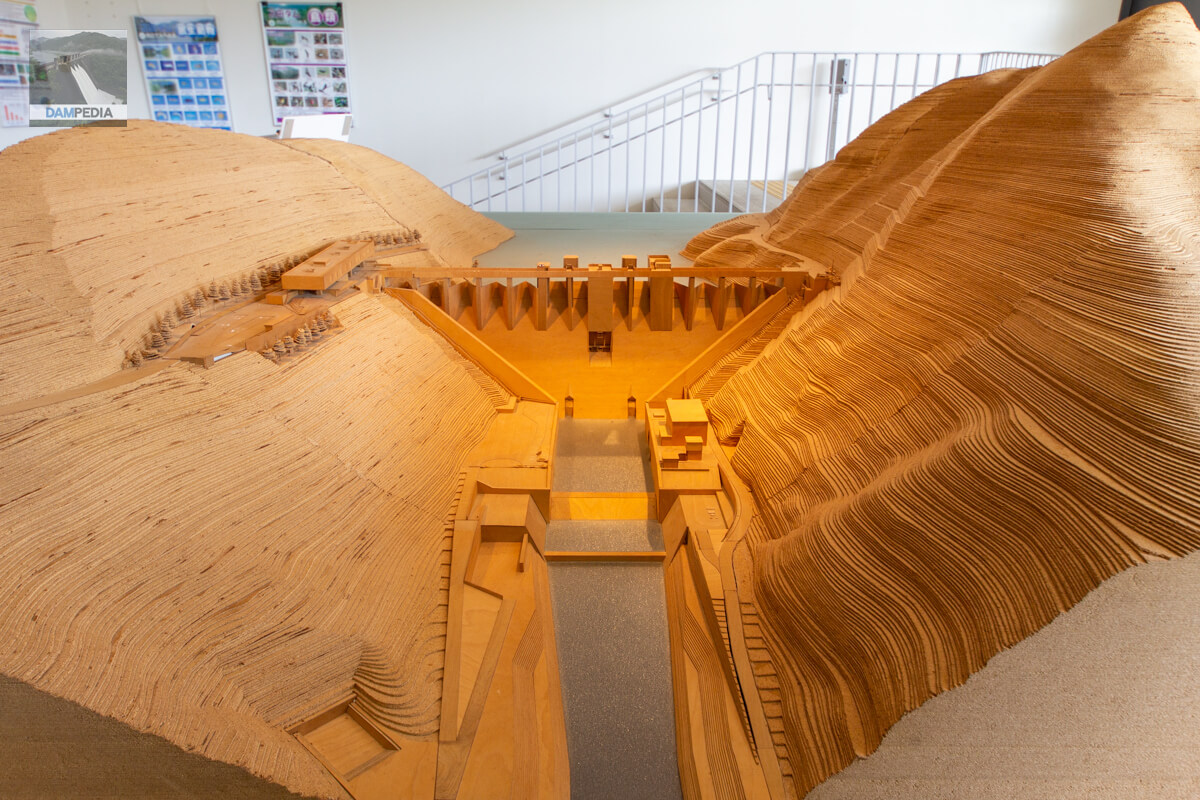
Overall model of Tomata Dam
This is a huge model of the Tomata Dam made of cork and wood. I think the mountains are made by laminating cork one by one, but this is a great...
Rim tunnel behind the control center
I went outside from the archives. There is a rim tunnel behind the administration office, although it is not accessible.
Downstream view of the levee from the observation platform next to the reference room
The Tomata Dam can be seen from various angles as if to say, "Please take a look". Inevitably, there were many photos, and it was a bit difficult to select the best ones this time. This article is barely halfway through.
View of the top edge from the right bank
At that time, I thought something like, "I wish there was an observation deck on that mountain," but later that thought would come true in a slightly different way.

Looking downstream from the top
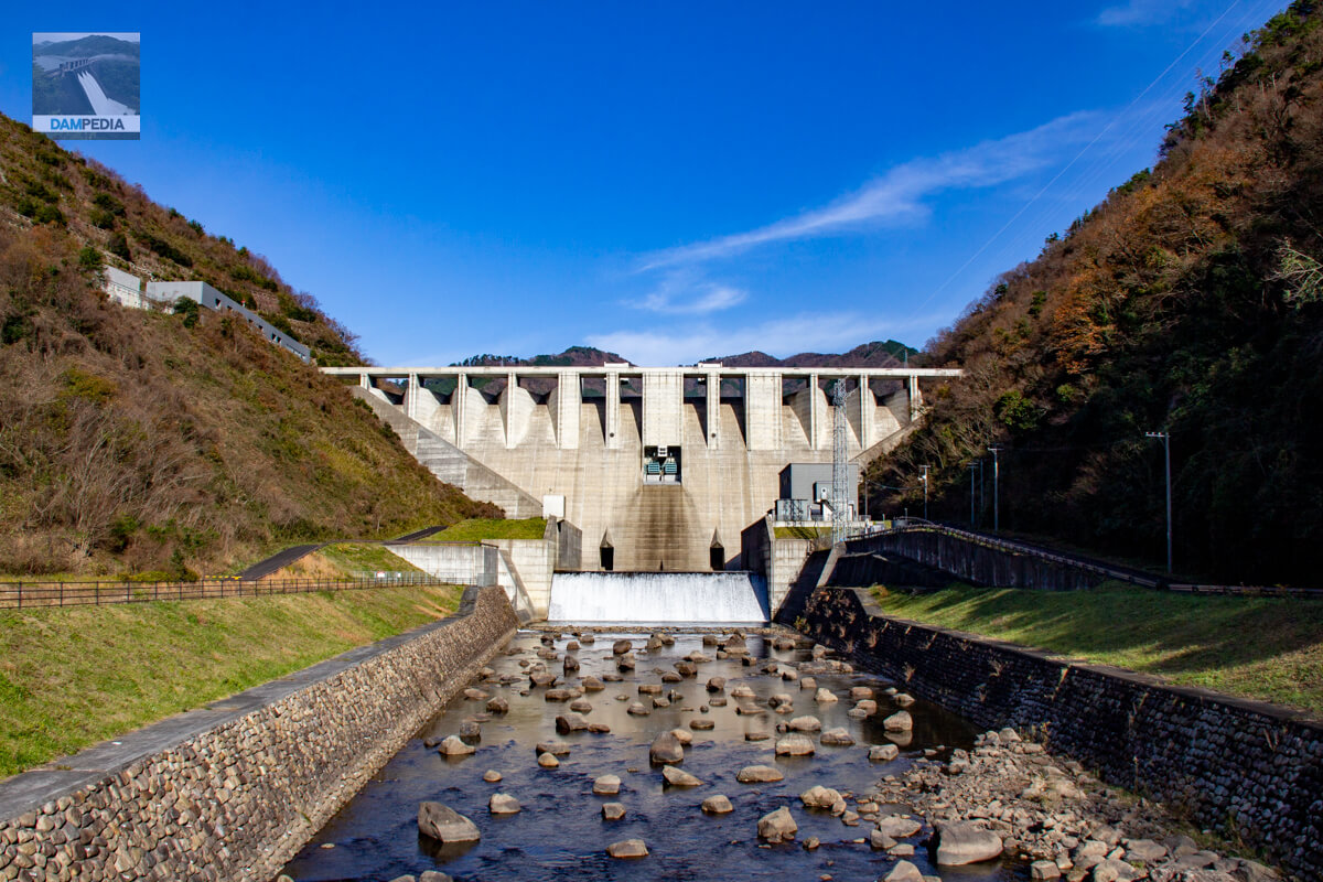
The Tomata Dam may be a good location for dam enthusiasts. Although the dam is built in a valley, it is not uncommon for dams to be built where the river curves, and often it is impossible to look up at the embankment from downstream, even though it is a very good dam. The Tomata Dam has a 500-meter straight line downstream, so that its appearance can be taken in from downstream.
Near the left bank of the embankment
I returned to the left bank. I was very happy to see that there is a space to walk on the downstream side of the left bank, and that this place, which tends to be off-limits to visitors, is also open to them.
View of the downstream face of the dike from the observation area on the left bank
Here is the Tomata Dam as seen from the location in the photo above. The levee looks shining because of the timing of the forward light.
Is that... an observation deck?
I came to the left bank and noticed that the mountain on the right bank was an observation deck.
Back to the right bank...
Since that time, my boom has been "to climb up to the observation deck when I find one". Some dams have "fake observation deck" with no view at all, but you have to climb them to find out if that is actually the case or not.
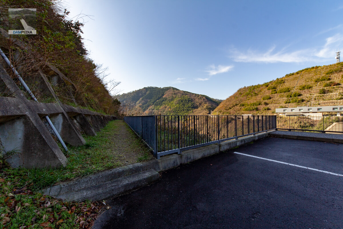
To reach the observation deck at the Tomata Dam, move further south from the control center on the right bank, and you will see a staircase railing on your right.
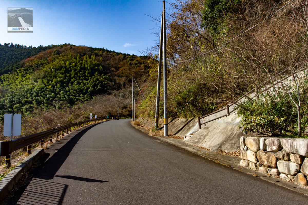
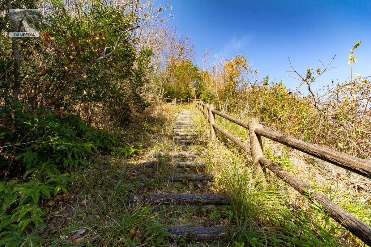
Stairway to Heaven
Climbing with determination.

Climbing...
The stairs and handrails are well maintained, so to say it is easy to climb is an understatement, but it is an uphill climb.
Occasional glimpses of the levee
I climbed the stairs slowly, step by step, with high hopes for the view from the observatory.
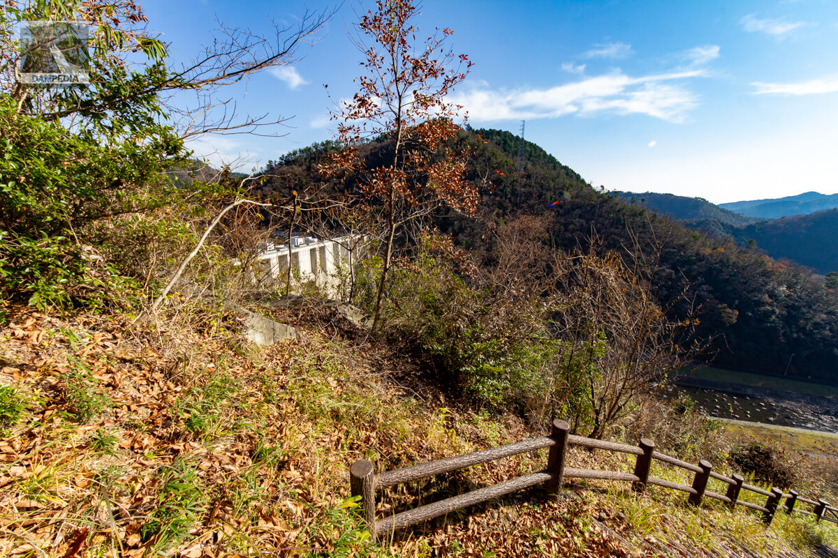
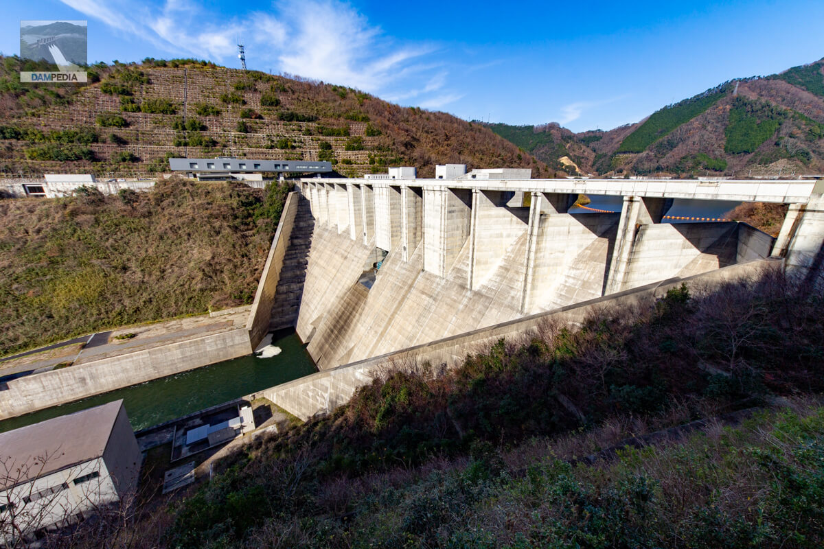
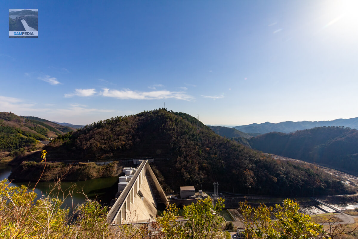
View of the levee from the right bank observation platform
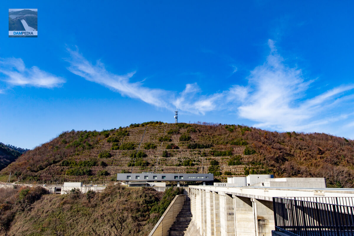
It is not a bad observation platform. It would be nice if the entire embankment could be seen a little more clearly, but to do so, it would be necessary to install a lookout tower with a pillar looming up from the mountain slope.
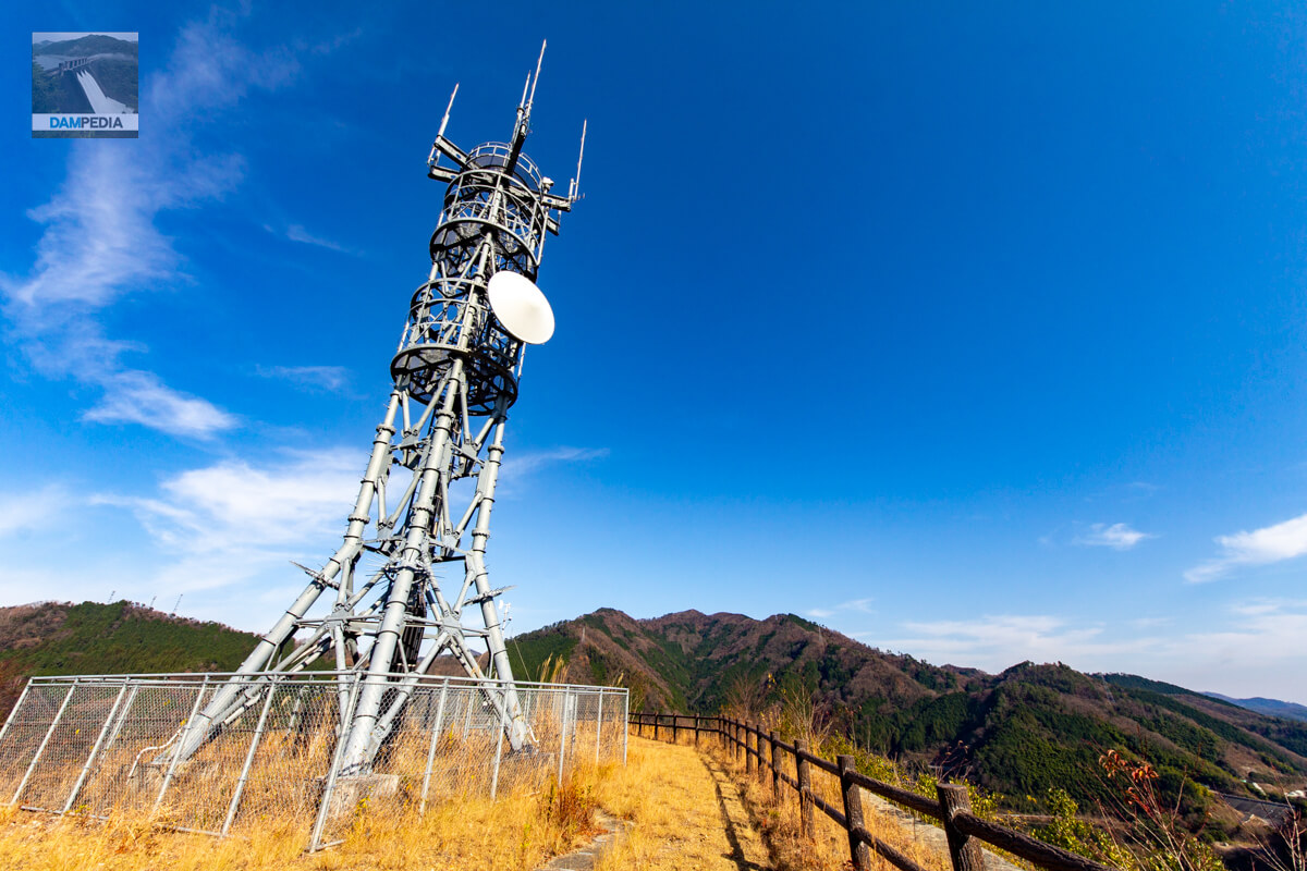
Antenna tower
The observatory is equipped with a radio tower for microwaves and other equipment necessary for the management of the Tomata Dam, I believe.
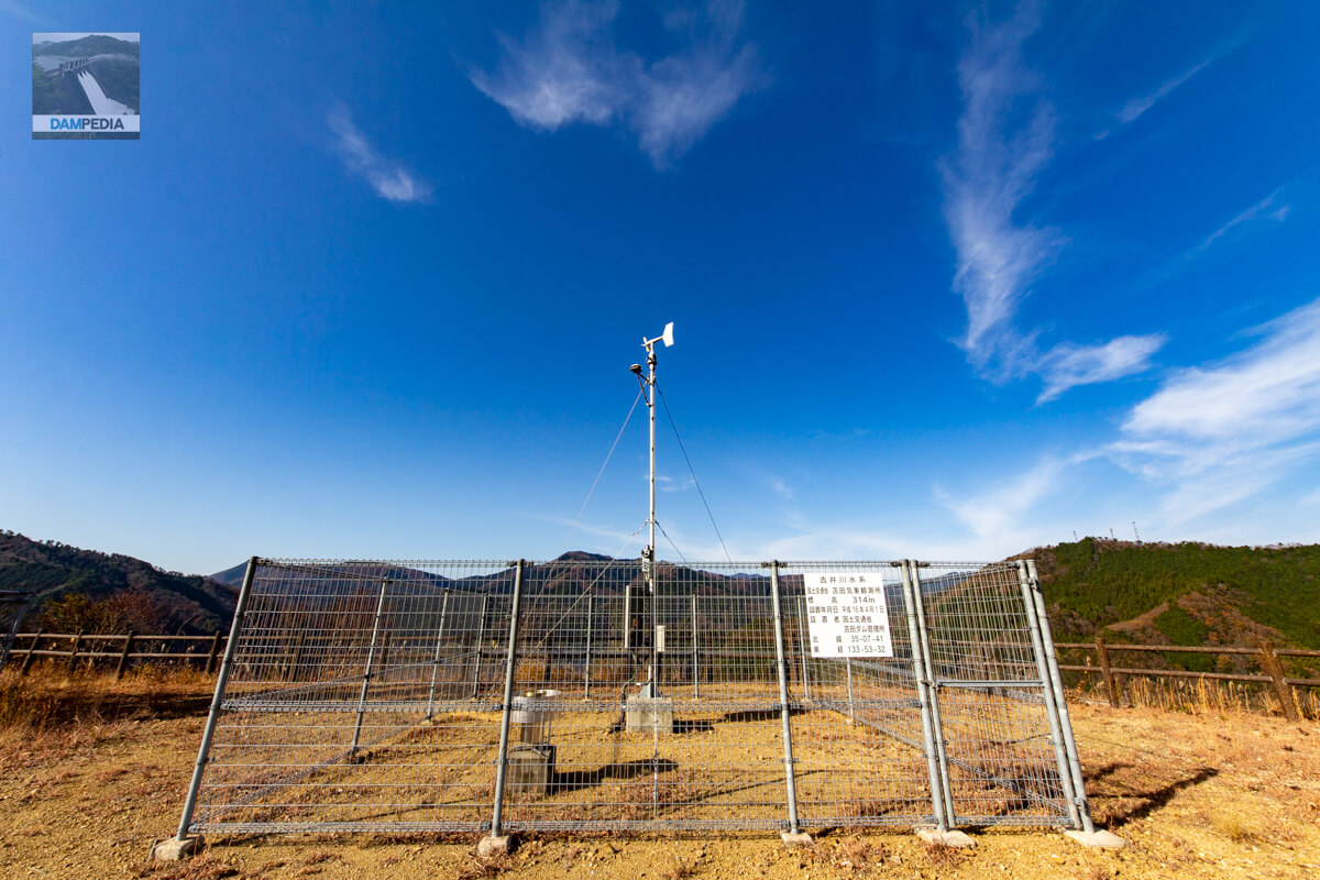
Tomata Weather Observatory
This is a meteorological observatory set up by the Tomata Dam Management Office.
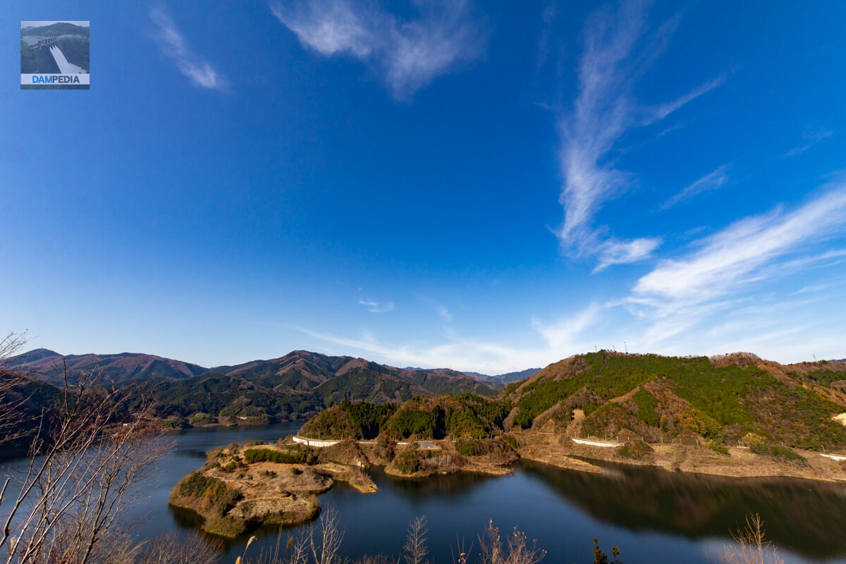
View of Lake Okutsu from the observatory
It is not in the direction of the embankment, so some dam enthusiasts may have different tastes, but I thought it was well worth the climb up to the observation deck just to enjoy the view.
View of the upstream face of the Tomata Anbu Dam from the observatory
Although it may be difficult to see with the naked eye, the camera's zoom lens can be used to capture the upstream face of the Tomata Anbu Dam.
View of the top of Tomata Dam from the observation deck
Although the grass and trees in the foreground are a bit obstructing, I can manage to capture the top of the Tomata Dam from above the dam axis.
Leaving the observatory
It is a bit of a challenge to get down there, but I will leave the observatory and head downstream to the levee.

View of the levee from the stairs to the observatory
You can also see the Tomata Dam in the middle of the stairway, but it is regrettable that the front side is inevitably hidden.

Downstream view of the levee from the bridge downstream
I have come to the downstream. It is truly a wonderful dam to be able to capture the downstream face so well.
View of the water level maintenance discharge facility and its observation room from the bridge downstream
This is a god-like layout! The viewing room is located in the upper center of the pulling radial gate of the water level maintenance discharge facility with two gates in a row. I think this is the only dam like this.
View of the sub-dam from the bridge downstream
At that time, only power generation discharge was taking place, but even so, the sight of the water flowing over the sub-dam was also beautiful.
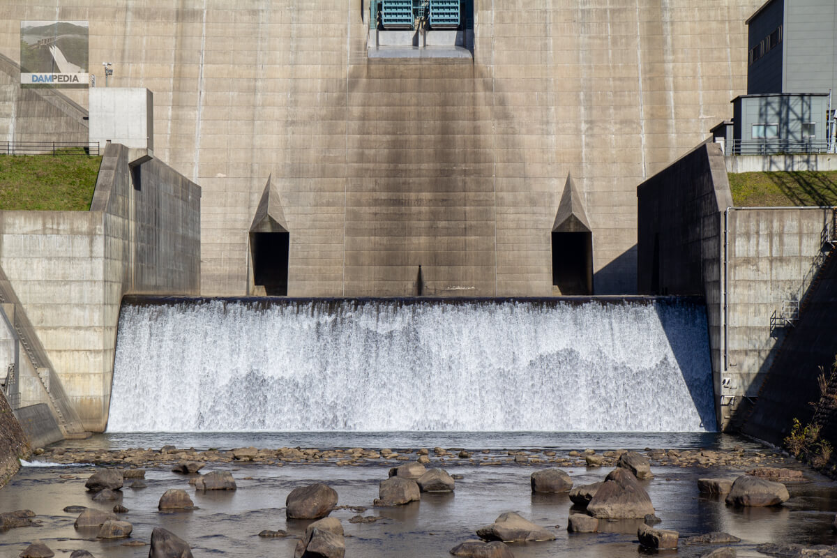
View of the labyrinth-type free overflow crest from the bridge downstream
The labyrinth seen from downstream also has an amazing shape. The straight flood discharge on the right appears to be one step lower in bed height, but I think this is an illusion due to depth.
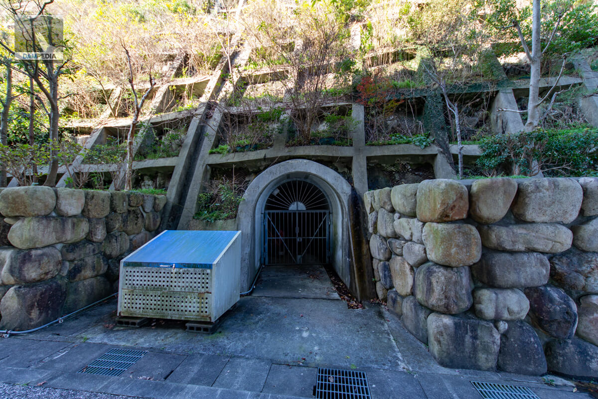
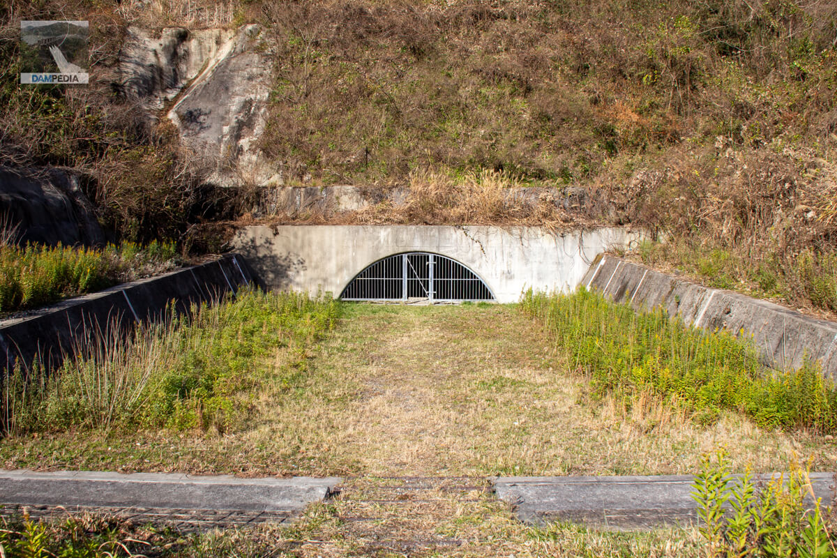
Temporary drainage tunnel
I have crossed the bridge to the right bank. On the right bank, the remains of the temporary drainage tunnel can be seen freely. Most of the temporary drainage tunnels of dams are completely hidden from view by iron doors, but the Tomata Dam even has a stairway that asks visitors to look at it.
Temporary drainage tunnel interior
The tunnel is fenced off and cannot be entered, but the interior can be seen through a gap. It appears that the tunnel has been opened for tours in the past and is being considered for utilization.
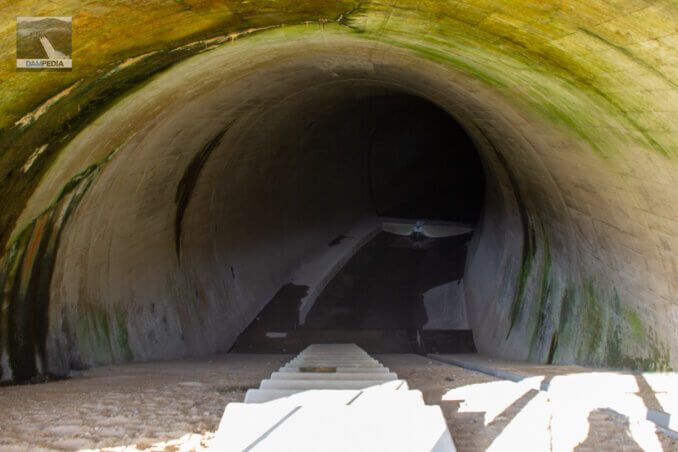
Stairs at the exit of the temporary drainage tunnel
Looking toward the Yoshii River from the tunnel. The tunnel was originally dug down to the riverbed to join the main stream of the Yoshii River as an outlet for the diversion works, but it has been filled with earth like an embankment. For this reason, a stairway has been provided.
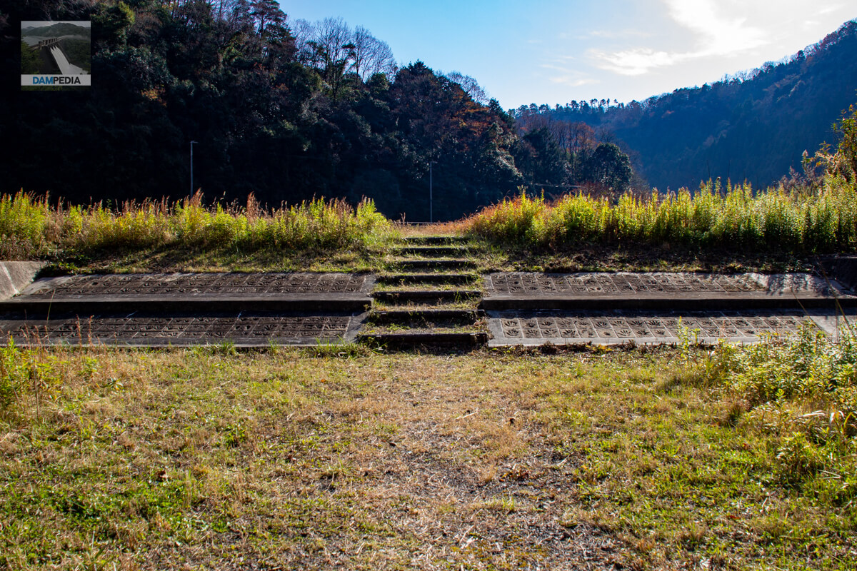
Handprint
On both sides of the stairway are handprints that appear to be those of local elementary school students. Since some of the handprints are dated 1999 and some are dated 2000, which are not the same, and since the Tomata Dam was under construction and Kuta Elementary School, which was located on the proposed submerged site, was closed in 1992, it was not clear why the handprints were taken and stored here.
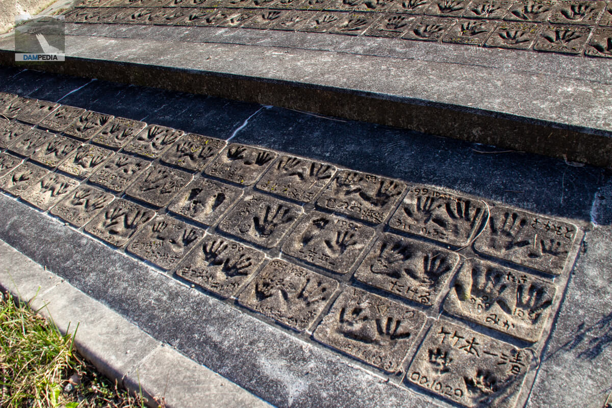
I happened to see a blog where a person who saw the bill wrote, "It looks like a resentful thing," but I think that is a very narrow-minded view. It is true that there was great opposition to the construction of the Tomata Dam, but in the end, they agreed to build it for the benefit of downstream beneficiaries, and even if they made the handprints according to the instructions of their school teachers, would there really be elementary school students who would leave them for the sake of eternal resentment?
View of the reservoir from Lake Okutsu, Mizu-no-Sato
After leaving the dike, we had lunch at "Mizu-no-Sato Okutsu-ko" run by the NPO Tecchiriko, located upstream. This facility is run by local residents, and the NPO was founded with the idea that "we have no choice but to support our own community by ourselves. Since they are working positively, I am left wondering what the writer of the aforementioned blog saw in them that made him "resentful"?

If the local people have a negative image of the area, no one will come close to it. I am sure that the people who planned the Tomata Dam and the surrounding development also wanted to attract many people and arrived at that wonderful ground design.
Certainly, the activities of the past are submerged in this torrent of water in Lake Okutsu. However, the water and dam are now a treasure to be utilized by the community, and will continue to be one of the bases for the development of the region in the future.
Tomata Dam Specifications
| Location | Kuda Shimobara, Kagamino-cho, Tomata-gun, Okayama |
| River Name | Yoshii River System Yoshii River |
| Objective | F (flood control, agricultural disaster prevention) N (unspecified water, water for river maintenance) A (irrigation water) W(Water for water supply) I (industrial water) P(Power generation) |
| Model | G(gravity-fed concrete dam) |
| Bank height | 74m |
| Bank length | 225m |
| Dam volume | 300,000m3 |
| Watershed Area | 217.4 km2 |
| Reservoir area | 330ha |
| Total storage capacity | 84,100,000 m3 |
| Effective water storage capacity | 78,100,000 m3 |
| Dam operator | Chugoku Regional Development Bureau |
| Main body constructor | Sato Kogyo, Konoike Corporation, Aisawa Industry Co. |
| Year of launch | 1972 |
| Year Completed | 2004 |
| Name of Dam Lake | Okutsuko (Lake Okutsu) |
Other facilities/observations
| Parking lot | ○ |
| Toilet | ○ |
| Park | ○ |
| PR Exhibition Hall | ○ |
| Fishing | ○ |
| Viewing platform | ○ |
Map around Tomata Dam
Weather around Tomata Dam
Accommodations that may be close to Tomata Dam


Comment